Philadephia and the surrounding area are so lucky to have Wissahickon Valley Park! If you’re looking to escape the hubbub of the city and spend some time outdoors, this is the place to do it.
There are so many fabulous hiking trails at Wissahickon Valley Park. From easy and accessible (Forbidden Drive) to fun and moderately challenging (the Orange Trail), there is something for every ability.
We’ve been hiking at Wissahickon for years and have tried to explore each area of the park. But, of course, we have some favorite trails, which I share below. So, if you’re looking for some good trails in Wissahickon to check out on your next visit, keep reading!
Disclosure: Some of the links below are affiliate links, meaning, at no additional cost to you, we may receive a commission if you click through and make a purchase.
Hiking at Wissahickon Valley Park
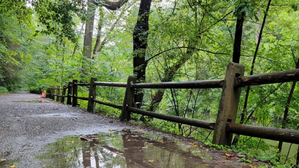
Wissahickon is a gem inside Philadelphia. As one of the best places to hike in the Philadelphia area, it offers trails of varying difficulty levels for runners, bikers, and hikers. In fact, it’s fun just to stroll along Forbidden Drive and enjoy a view of the creek.
There are more than 20 miles of trails inside Wissahickon Park, and they connect and intersect in multiple places, giving you countless combinations. There are so many fun hidden gems inside the park, too. We’ve been hiking here for years, and although we’ve explored many areas of the park, we still haven’t covered the entire thing!
Prepare For Your Hike at Wissahickon
Amenities
There are very few restrooms inside Wissahickon Valley Park. During the busier months, port-o-johns are located in some of the parking lots. The Friends of Wissahickon interactive map can help you find the restrooms.
Parking
There are several parking lots and street parking around the park. Parking tends to be limited on nice weather days, especially on weekends. Arrive early, especially on weekends during the spring, summer, and fall.
Please remember that many park entrances are at the end of neighborhood streets. When you park, be respectful of the area’s residents by not blocking driveways or roads.
Vistor Tip: While we’ve never had an issue parking at Wissahickon (knock on wood), I’ve heard several stories about windows broken and items stolen from cars. With that in mind, make sure to lock your cars and hide anything of value.
Pets
Dogs are required to be on a leash at all times inside Wissahickon Valley Park. However, many dog owners disregard the rule and let their pets roam off-leash. Keep that in mind when deciding to bring your pet along on your hike.
Limited Cell Service
There are some areas of the park where we’ve experienced poor or no cellular service (the parking lot on W. Bells Mill Road, for example). It’s always a good idea to download a map before you visit.
Be a Responsible Visitor
Remember, as you visit this park, to respect nature. Stay on established paths, pack out your trash (including food waste), and leave what you find behind.
The more popular these destinations become, the more we need to be diligent about keeping our parks and lands clean and safe for all. You can learn more here.
5 Fun Hiking Trails at Wissahickon Valley Park
W. Bells Mill Road to Rex Avenue Loop via Orange and White Trail
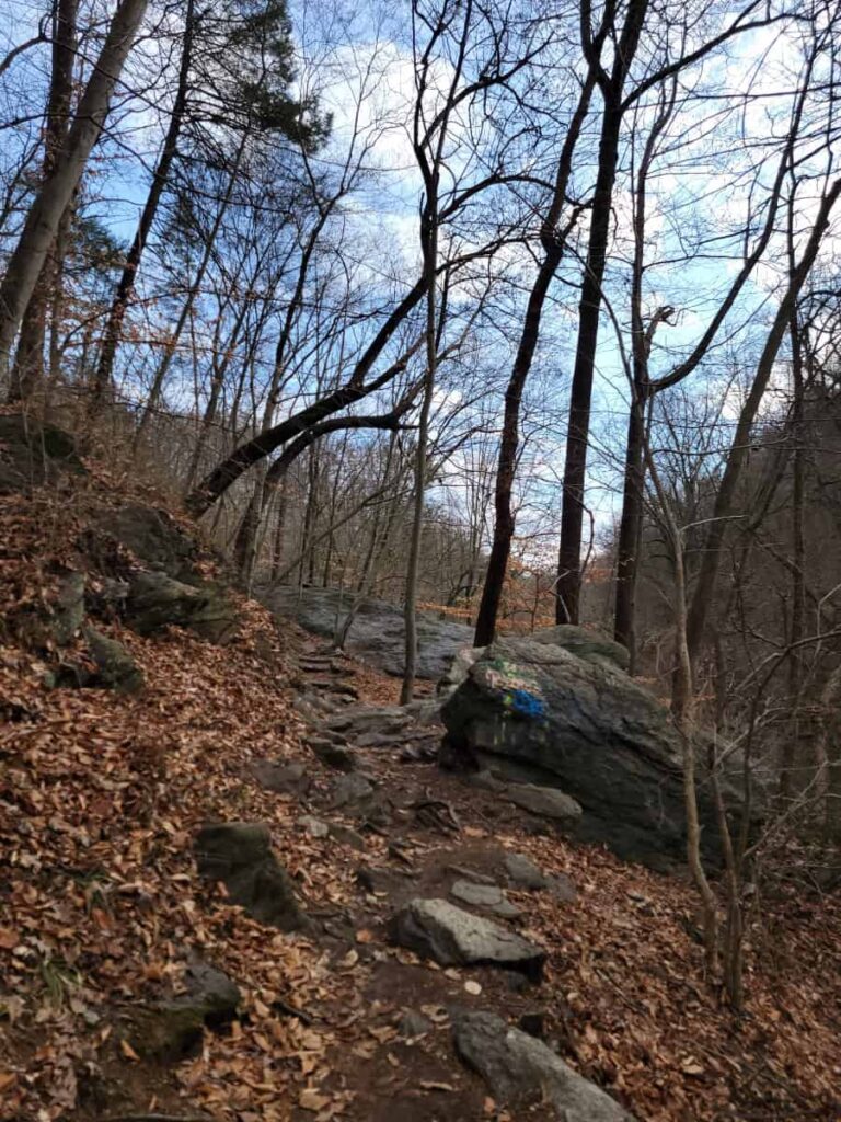
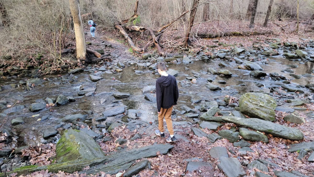
One of our favorite trails in Wissahickon Valley Park is the Orange Trail, so we try to incorporate it into all of our hikes if possible. This loop is fun and moderately challenging.
Start on the Orange Trail on West Bells Mill Road and head south. You’ll encounter several rocks to climb over and around, and enjoy a gorgeous view of the Wissahickon Creek below.
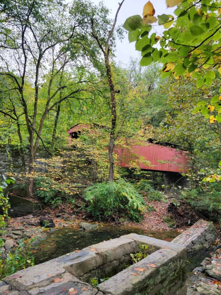
You’ll see the Thomas Mill Covered Bridge about halfway along the Orange Trail. It’s the only covered bridge in a major city in the US, so it’s worth detouring here to grab a picture and enjoy the rushing sounds of the water.
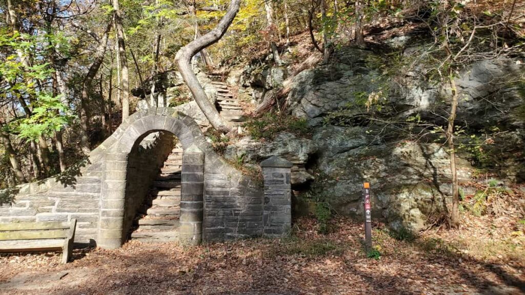
Continue south along the Orange Trail until you reach Rex Avenue. You’ll know you’re there by the beautiful stone steps and archway you have to walk through. It might be my favorite spot in the park!
From there, make a left and head east about 400 feet to the White Trail entrance. Once you reach the White Trail, make a left and head north.
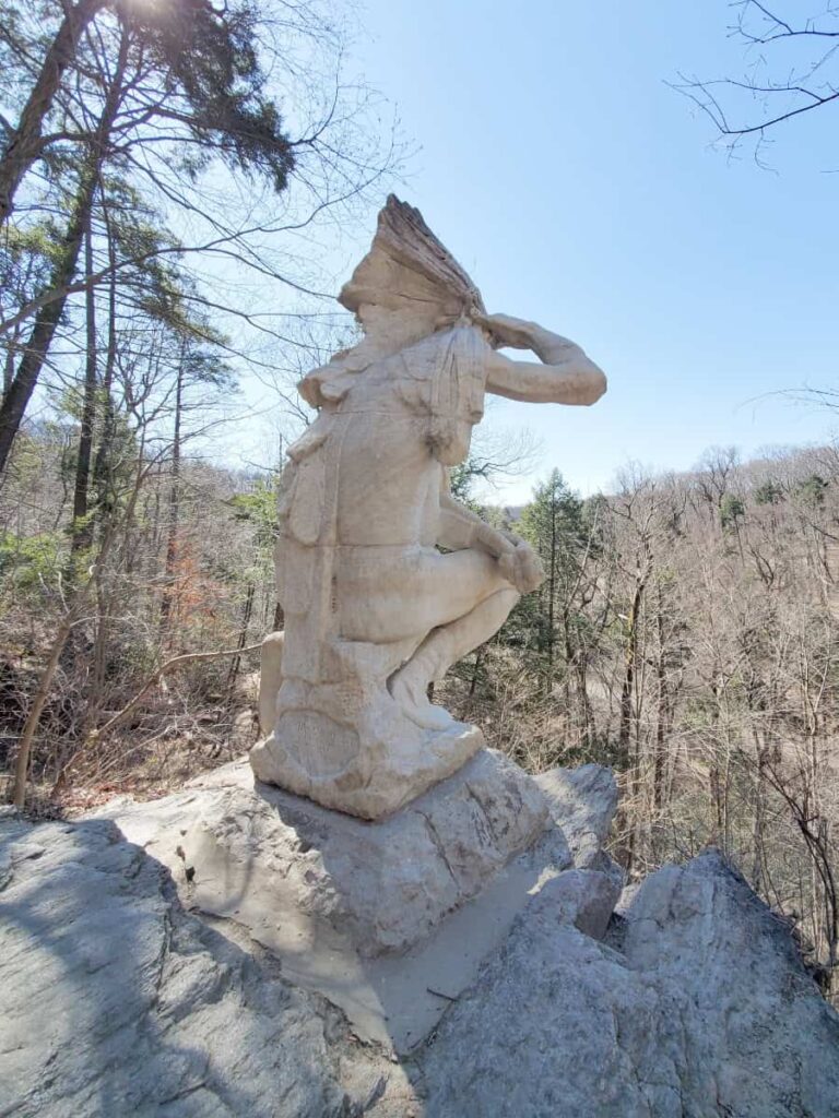
About 1/10 mile into the White Trail, you will see some stone steps on your left that lead down to a marble statue supposedly depicting Teedyuscung of the Lenape people. However, the Lenape never wore headdresses like the statue, so it’s not an accurate portrayal. But it’s still cool to see!
Continue along the White Trail for about another 4/10 miles. You’ll encounter an area where there is a bench and the trail splits. The White Trail heads to the right (east), and an unnamed trail heads to the left (southwest). You should see “Bells Mill Road” at the bottom of the trail marker. Take that trail about 1/10 mile until it connects with the Orange Trail.
From there, follow the Orange Trail north until you reach West Bells Mill Road, where you started.
Valley Green to Livezey Lane Loop via Orange and White Trail
This might be one of the most popular sections of Wissahickon Valley Park, thanks to the Devil’s Pool.
During the summer, you’ll most likely encounter many people along the trail, as well as a lot of trash. However, if you visit in the late fall, winter, and early spring, you’ll enjoy fewer crowds and an overall better experience.
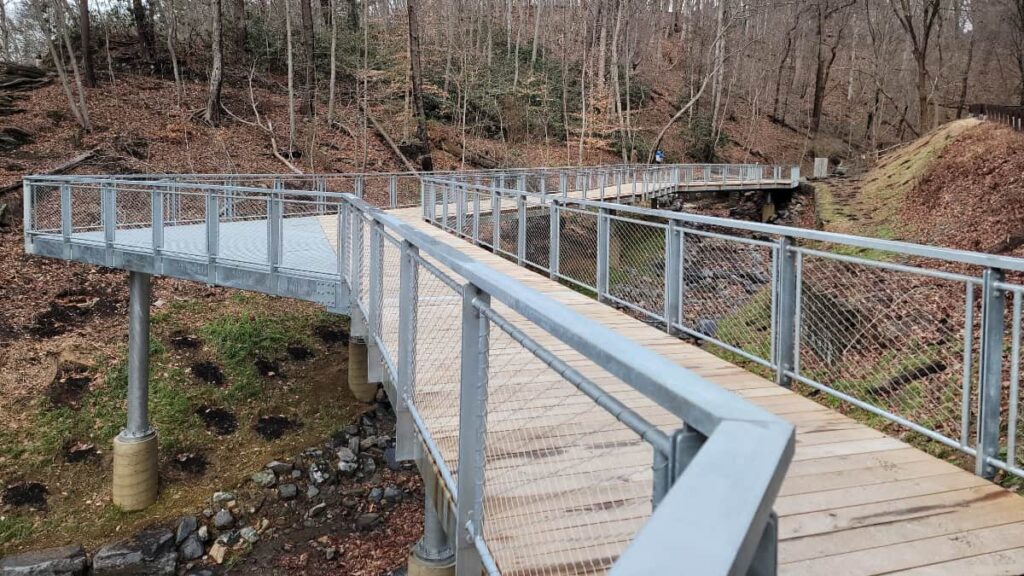
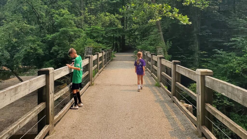
Start by parking at the Valley Green Road parking lot and taking the walking trail west towards Wissahickon Creek. Enjoy the new pedestrian bridge and walkway that the Friends of Wissahickon helped build in 2024! It’s absolutely gorgeous.
Before you cross the bridge across the creek, head south (left) on the Orange Trail. Typical for the Orange Trail, it’s moderately challenging, with steep sections and large rocks to navigate.
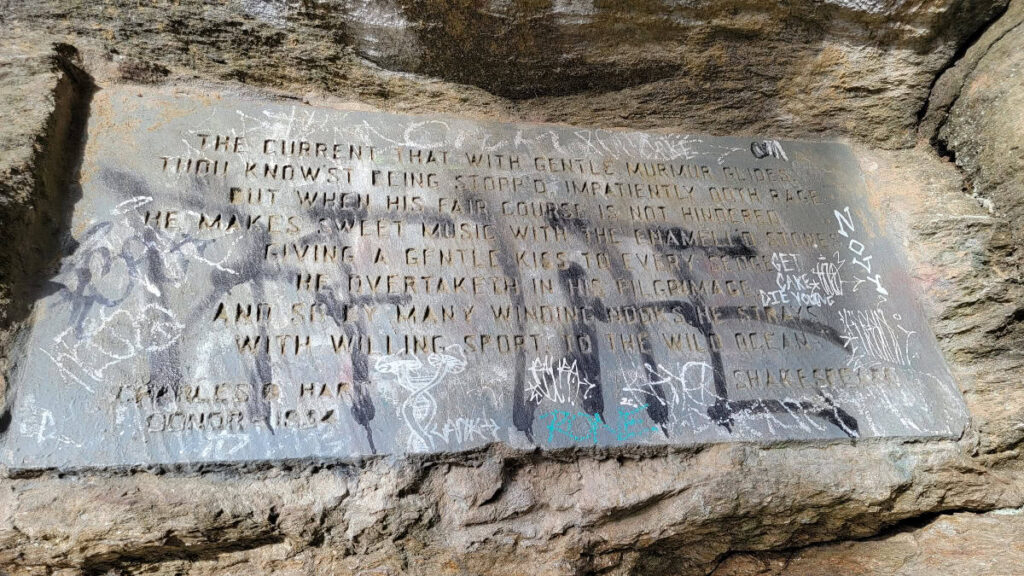
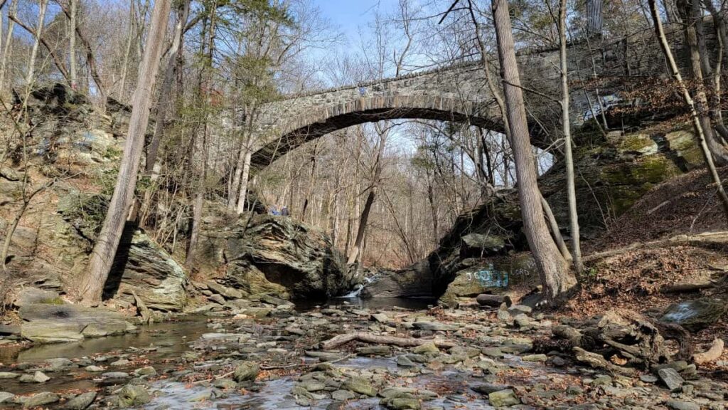
You’ll encounter the Devil’s Pool about a 1/2 mile from Valley Green Road. This is where Cresheim Creek flows into the Wissahickon Creek, forming a small waterfall and a deep pool. There is a lot going on in this section, including an old stone aqueduct crossing the Cresheim Creek and a plaque with a Shakespeare quote on the rocks.
You’ll have to cross Cresheim Creek to continue along the Orange Trail. Usually, it’s pretty easy to hop along the rocks and avoid the water. But after a substantial rainfall, you might find it challenging to maintain dry shoes.
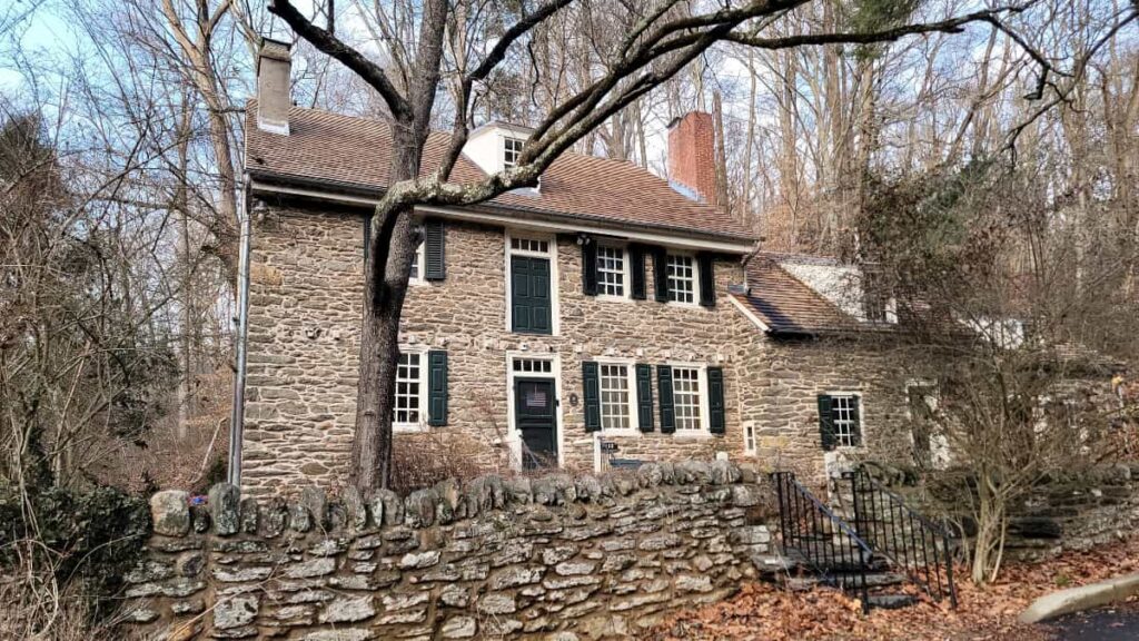
After crossing, head up the stone steps and continue until you reach Glen Fern, an old stone home of miller Thomas Livezey that dates back to 1747.
Make a left and walk about 1/10 mile east on Livezey Lane to the White Trail entrance. The White Trail is higher in elevation than the Orange Trail, so it’ll be a bit of a climb. Once you reach the White Trail, make a left and head north.
At about 3/10 miles, the trail splits, and the White Trail makes a hard left. You’ll end up crossing Cresheim Creek again, as well as a tributary, but it’s a smaller crossing, so you’re less likely to get your feet wet.
Continue along the White Trail until you reach Valley Green Road, and then take the pedestrian bridge and walkway back to the lot!
Valley Green Orange Trail and Forbidden Drive Loop
One of the interesting finds around Wissahickon Valley Park is the Fingerspan Bridge. Designed by artist Jody Pinto, it combines form and function and is a unique detail inside the park.
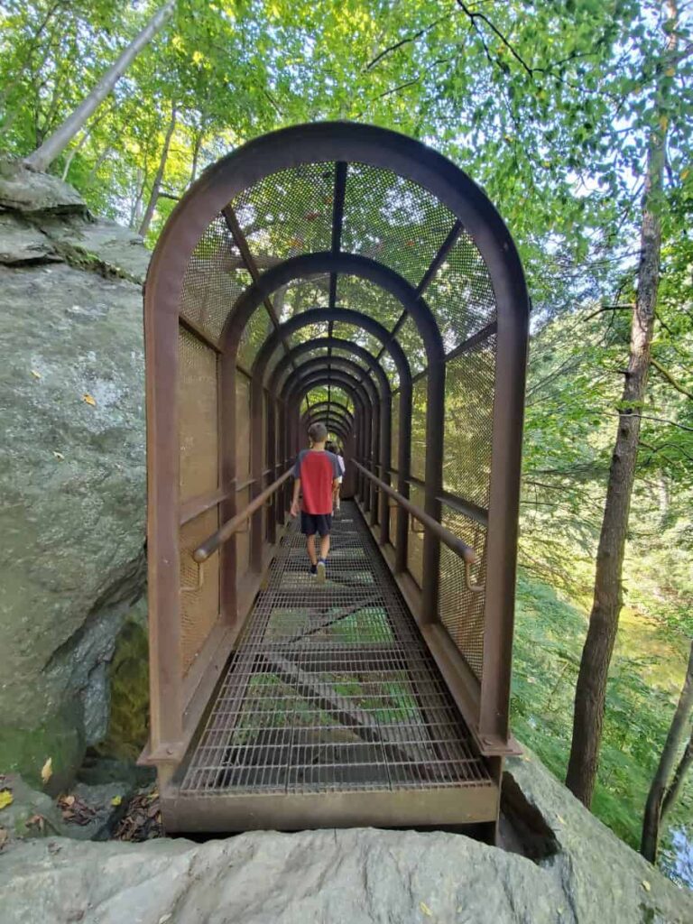
Our favorite way to get to the Fingerspan Bridge is to park at Valley Green Road and follow the Orange Trail south, just like the trail detailed above. However, instead of connecting to the White Trail by Glen Fern, you’ll cross Livezey Lane and continue south along the Orange Trail for 3/10 miles until you reach the bridge.
After crossing the Fingerspan Bridge, continue south along the Orange Trail until you reach the Mount Airy Avenue trail.
For an easy return to the Valley Green Road parking lot, cross Wissahickon Creek and then head north on Forbidden Drive for just over 1 mile. You’ll cross the creek again just after the Valley Green Inn to return to the parking lot.
Otherwise, you can head northeast towards the Mount Airy Avenue entrance and pick up the White Trail (it’s next to the frog pond). This will make the loop 3 miles long.
Gorgas Creek to Yellow Trail Loop (From Mount Airy)
Where to Park: Along West Mount Airy Avenue between Mount Airy Terrace and Wissahickon Avenue.
Trail Length: 2.3 miles
Elevation Gain: 330 feet
This isn’t the most exciting trail in the park, but you’ll still see some interesting things including a cave, an old spring house, and several interesting water crossings. It’s also easier than other trails in the park.
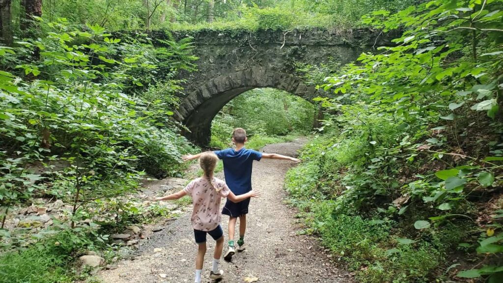
Start at the Mount Airy Avenue entrance. We like to park here for this trail since it’s easier to park here versus Gorgas Lane. Follow the trail straight down to Wissahickon Creek. You’ll pass a large pond on your right and walk under a stone archway before reaching the creek.
Cross Wissahickon Creek and turn right (north) on Forbidden Drive. Follow Forbidden Drive for about 1/10 mile until you reach the entrance for the Yellow Trail on your left, just before the bridge that crosses Gorgas Creek.
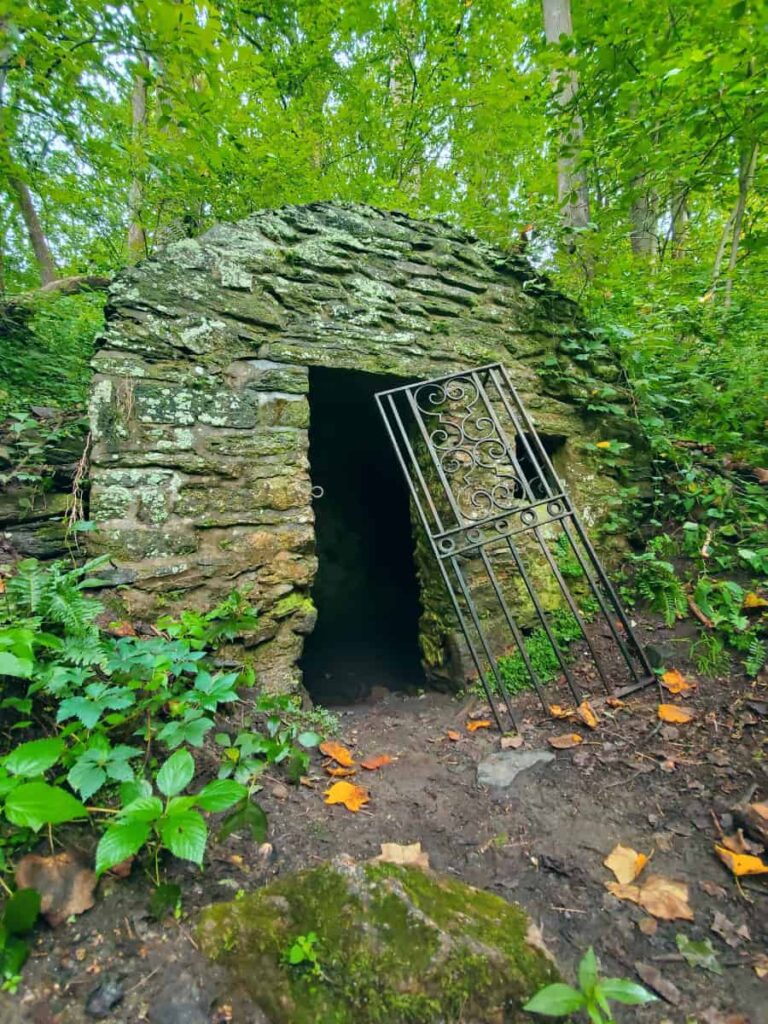
Before you get to the Yellow Trail, you’ll pass an old spring house on your left. There are stone steps leading up to it. You can walk up and peek inside – maybe you’ll spot a frog!
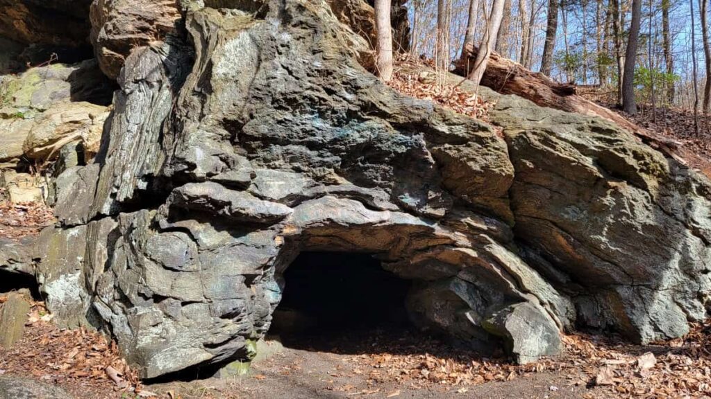
If you want to see the Gorgas Creek Cave, follow the Yellow Trail for about 250 feet and then look for a worn-down path on your right, just after crossing the Gorgas Creek. This is not an official park path, but it has become a popular “desire” trail in the park. The path is about 100 feet long and leads to the small cave.
Continue along the Yellow Trail until you cross a waterway, then make a left to follow the Yellow Trail south. Stay on the trail for about one mile until you reach the Janette Street trail. Make a left towards Forbidden Drive. To return to Mount Airy Avenue, follow Forbidden Drive north about a half-mile, then cross the creek and stay on the trail.
Kitchens Lane Yellow and Orange Trail Loop
Beware of flying balls on this trail! This fun trail takes you under the Walnut Lane Bridge and to Lover’s Leap. But it also passes the Walnut Lane Golf Club, and we all know golf shots don’t always go where you want them to! Overall, this trail is on the easy side of moderate.
Start at the Kitchens Lane parking area. This is a smaller parking lot, but since it’s not as popular as other areas of the park, you can usually find a parking spot. You can access two trails from this lot: the White Trail and the Kitchens Lane entrance trail. Take the Kitchens Lane trail, not the White Trail.
Follow the Kitchens Lane entrance trail to the Kitchens Lane Bridge and cross the Wissahickon Creek. It’s such a cute, small bridge that is truly pedestrian only. After crossing, make a left and head south on Forbidden Drive. After about 50 feet, you’ll see the Yellow Trail entrance on your right.
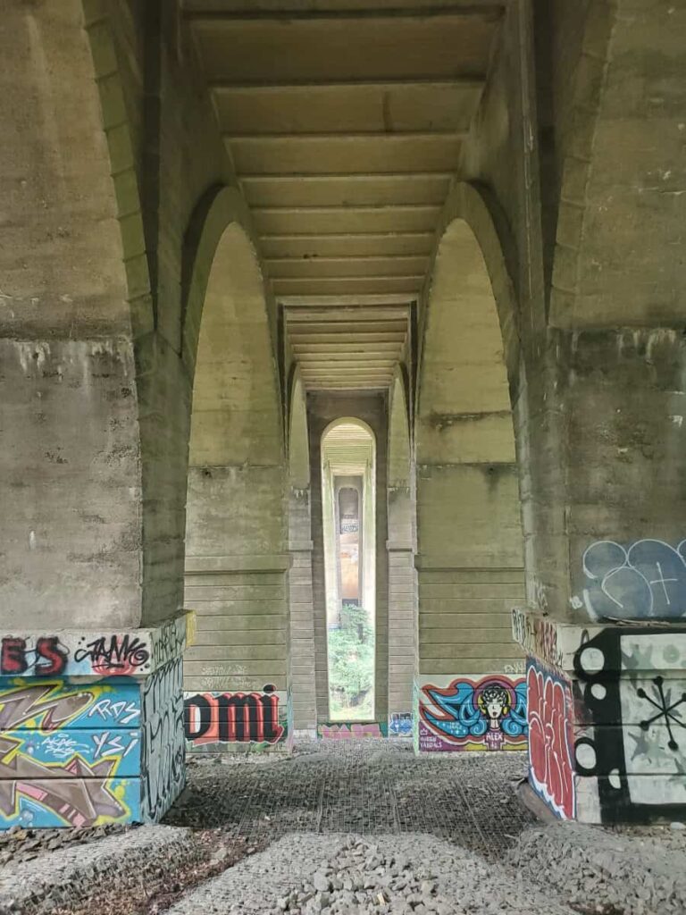
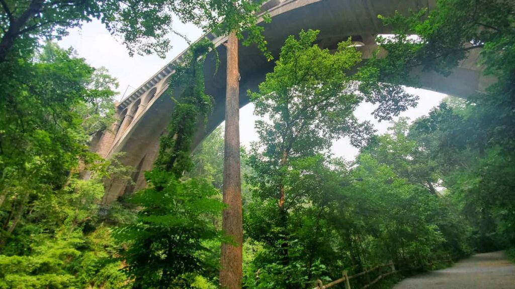
Follow the Yellow Trail south for about 1 mile until you reach Lover’s Leap. Along the way, you’ll pass under the Walnut Lane Bridge. It’s a terrific spot for photos! (Side note: this reminds me of the abandoned quarry at Monocacy Hill).
You’ll also pass the Walnut Lane Golf Club (at one point, it feels like you’re walking on the actual golf course) and you’ll most likely see thousands of golf balls. When we did this hike, we originally thought the balls were some weird fungus or mushroom until we got closer to them and figured out what they really were.
Just before you reach Lover’s Leap, you’ll see a trail marker on your left. This is the trail you’ll use to return. But stop and enjoy Lover’s Leap for a bit, first!
To return, follow the trail marked “Blue Stone Bridge” and “Forbidden Drive”. You’ll be on it for about 4/10 miles. Once you reach Forbidden Drive, make a left, and continue along for about a half-mile. On your return, you’ll walk under the Walnut Lane Bridge again. But this time, it feels a lot bigger!
Stop at the Toleration Statue viewpoint before you reach the Kitchens Lane return trail. There is an informational sign discussing the statue and how to see it. We visited in mid-summer, and the leaves made it impossible to see, but maybe during the winter/early spring, you’ll be able to see it.
Visitor Tip: This area of the park is one of the few places you’ll find a restroom. A vault/compostable toilet is located along Forbidden Drive, jsut north of the Kitchens Lane Bridge.
Wissahickon Hiking Trails Wrap-Up
As noted above, there are so many combinations of trails you can do at Wissahickon Valley Park. These are just a taste of the many options you have when visiting the park! But, you honestly can’t go wrong with any of them. Thanks to its history, unique features, and beautiful creek, Wissahickon Valley Park is always the perfect place for a day hike in Philadelphia.
Other Hikes Near Philadelphia
The Philadelphia area has a ton of great hiking trails! Some of our favorites are Mount Misery at Valley Forge and High Rocks in Ralph Stover State Park. Of course, there are even more, including beautiful creekside trails and waterfalls.
Related Content
Pin It For Later