So many features on one loop!
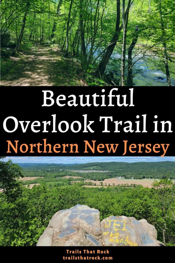
The central section loop at Point Mountain is about 3 miles long and has tons of fun features from rocky inclines to overlooks, gorgeous fields, and a peaceful walk along the Musconetcong River. Although it was steep to the overlook, the trail is mostly moderate, with lots of rocks to navigate.
This is a fun hike in North Jersey, in the uppermost part of Hunterdon County. It’s about an hour from Newark and Allentown, PA, and about 30 minutes from Easton, PA.
If this sounds like a trail you’d enjoy, the guide below has everything you need to know. So, let’s start planning your next adventure!
Disclosure: Some of the links below are affiliate links, meaning, at no additional cost to you, we may receive a commission if you click through and make a purchase.
Prepare For Your Hike at Point Mountain
Parking
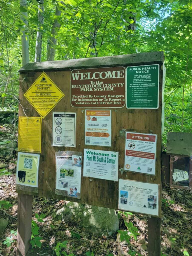
We parked at the small lot on Point Mountain Road where Musconetcong River Road dead ends. The lot holds about 4-5 cars. However, there were several cars parked along the road and also another small parking area off the road.
Amenities
There are no bathrooms or porta-johns at Point Mountain. There is a Quick-Check about 10 minutes away in Washington.
Wildlife
Point Mountain is home to many various species of snakes, including copperheads and timber rattlesnakes. Black bears also live in the forest. Always be aware of your surroundings and watch out for the wildlife.
Take Precautions
Hunting (when in season) is allowed at Point Mountain Reservation. During hunting season (between September and February), it’s best practice to wear bright orange (like this hat or vest) when hiking.
Part of the trail goes through a field. Although the trail portion is mowed, there is still a lot of long grass alongside the trail. Make sure to check yourself for ticks after your hike and wear insect repellent.
Download a Map
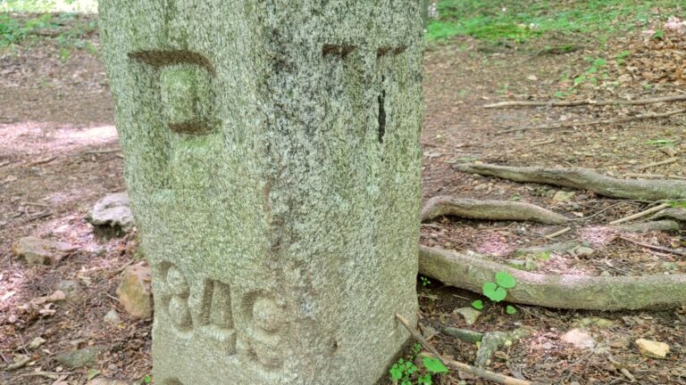
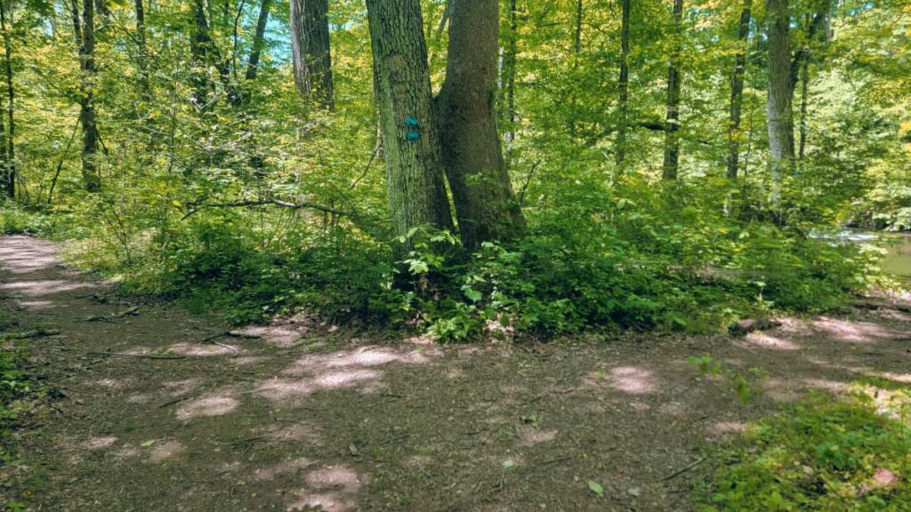
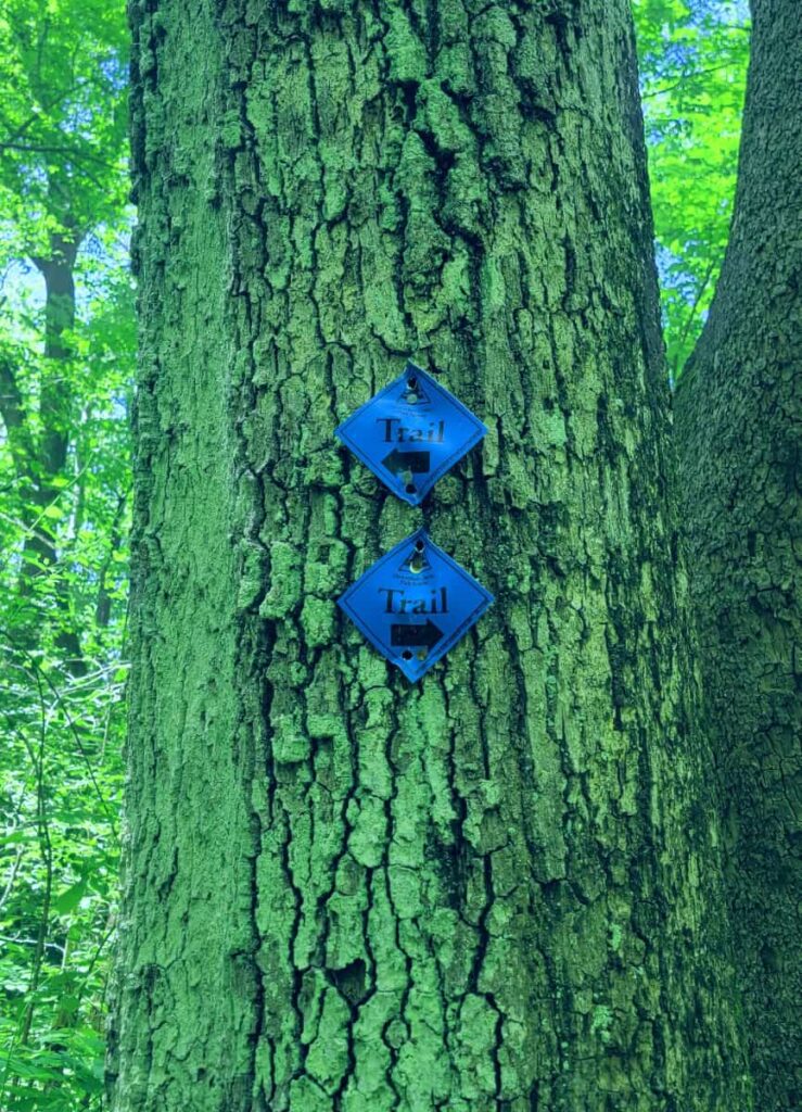
The trails at Point Mountain Reservation are clearly marked. But it’s always good to have a map.
Pets
Point Mountain is dog-friendly, but they must be on a leash
Be a Responsible Visitor
Remember, as you visit this park, to respect nature. Stay on established paths, pack out your trash (including food waste), and leave what you find behind.
The more popular these destinations become, the more we need to be diligent about keeping our parks and lands clean and safe for all. You can learn more here.
Point Mountain Orange and Blue Loop (Ridge & Riverwalk Trails)
| Trail Location: | Point Mountain and Musconetcong River Roads |
| Trail Length: | 3.10 miles |
| Trail Difficulty: | Moderate – It’s very steep for the first 1/2 mile |
| Trail Type: | Loop |
| Elevation Gain: | 585 feet |
| Dog Friendly: | Yes |
Trailhead
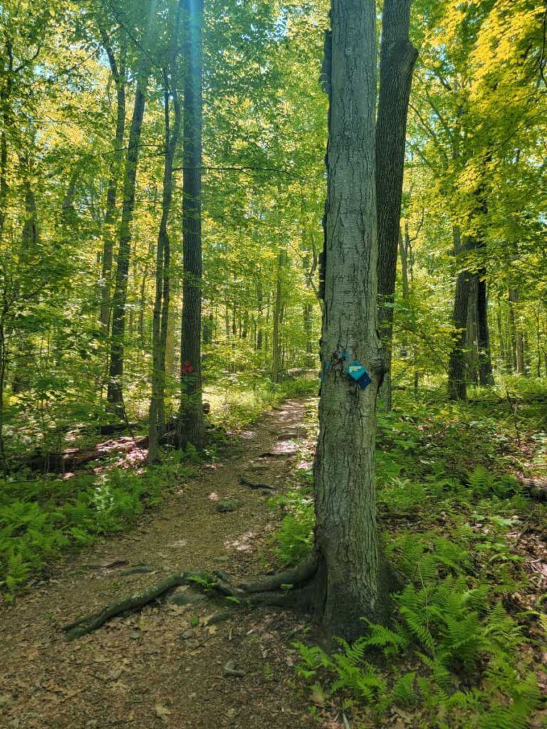
You can pick up the Ridge Trail (Orange Trail) at the small parking area on Point Mountain Road. The trail starts off marked with Blue trail markers.
You’ll arrive at an intersection in a short time. Here, you’ll want to stay straight and continue along the Orange Trail.
To the Overlook
It’s about a half-mile to the overlook. This is the toughest part of the entire loop, with steep and rocky inclines with grades up to 29%. The trail zig-zags a bit, so keep an eye out for the Orange markers.

You’ll also pass by “Private Property” signs with a view into someone’s backyard. I’m not sure if I’d love it or hate it having a home so close to the trail!
At the Overlook
There is a small clearing and rock outcropping at the top of the ridge that looks out over the farm, a housing development, and mountains in the distance. It’s a beautiful view!
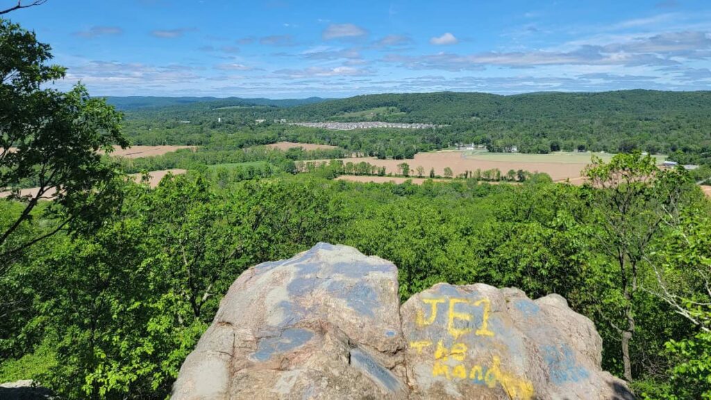
We sat on the rocks for a bit to enjoy a snack and drink before continuing on. If you only want the view, you could always backtrack down to the parking lot. However, we think finishing the loop is worth it.
Optional Hike Extension
After the overlook, you have the option to take the Yellow Trail or stay on Orange. If you’d like to extend your hike, you can take Yellow to White and then connect back to Orange. This will extend your hike by about a half-mile. We did not do this, so I can’t comment on the difficulty.
On the Ridge (Orange) Trail
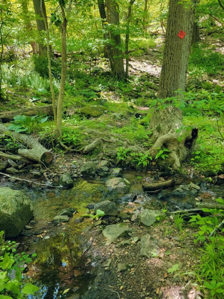
After the overlook, you’re on the Orange Trail for about 1.2 miles before reaching the fields. There are some elevation changes and rocky spots. But it’s not as steep as the initial climb. We had heavy rain a few days prior to our visit, so we dealt with some muddy spots along the trail and even a small water crossing.
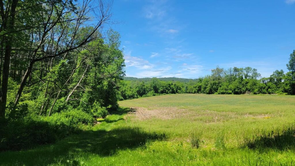
The Fields
As you reach the fields, there is a bench you can sit on to rest. It offers a nice view of the field! Follow the Orange Markers about .15 miles before you connect with the Blue Trail.
The grass was on the longer side for our visit, so I was concerned about ticks. But it was still clear enough as a single track.
Riverwalk (Blue) Trail
This is the easy section of the loop! This trail is wider and flatter than the rest of the loop and follows the Musconetcong River. It is the perfect way to end your hike.
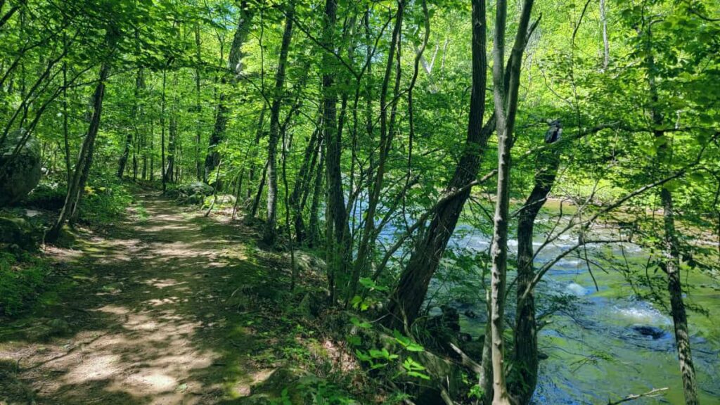
There are several short paths leading to the river from the trail. I assume they are made by the fly fishers, as we saw several of them standing in the river the day we were hiking.
About halfway along the Blue Trail, you’ll arrive at a fork in the road with Blue Trail markers pointing you in each direction. If you go left, you’ll return to the parking area. If you go right, you’ll follow the trail along the river. Both of these sections are about the same length, but staying right felt like the right choice since we could enjoy the river view a bit longer. However, this meant we had a short walk (500 feet) along Point Mountain Road back to our car.
Point Mountain Reservation Hiking Wrap-Up
Overall, I really enjoyed the trail. I loved that different elements along the trail, including the steep rocky climb to the overlook, the fields, and the beautiful walk along the river at the end. It reminded me a bit of the Monocacy Hill Recreation Area near Pottstown in Pennsylvania. I would definitely recommend this as a fun day hike in northern New Jersey.
Nearby Hikes (and Other NJ Favorites)
I need to spend more time exploring North Jersey, but there are a few hikes I can recommend close to Point Mountain. First, Schooley’s Mountain Park is about 15 minutes away. There you’ll find a fun loop leading to a pretty overlook and waterfall.
Worthington State Forest is about 30 minutes away from Point Mountain. It is home to two of our favorite trails: Mount Tammany Red Dot (great view of the Delaware Water Gap) and the Sunfish Pond Loop (the southernmost glacial lake on the Appalachian Trail).
Further away is Sourland Mountain Preserve. This beautiful park offers several miles of trails, fun boulders to climb on, and even a view of the Lower Manhattan skyline.
Pin It For Later