The Delaware Water Gap National Recreation Area covers 70,000 acres and stretches 40 miles along the Delaware River. So it makes sense that there are dozens of hiking trails in the region.
However, some hikes in the Delaware Water Gap are more popular than others. And for good reason! They offer fantastic views, some challenging terrain, and even waterfalls.
I’ve had the opportunity to hike many of those trails, and now I’ll share my favorites with you!
In this day and age, I feel the need to mention that I don’t use AI to write my posts!
I’ve hiked these trails, taken these photos, and collected this information personally (sometimes with the help of my friends, who are also real, live people). I appreciate you being here and utilizing my work for your future endeavors.
Also: Some of the links below are affiliate links, meaning that, at no additional cost to you, I may receive a commission if you click through and make a purchase.
Thank you for your support!
Prepare For Hike at the Delaware Water Gap
Day-Use Fees
As of publication, the National Park Service does not charge an entry fee for the Delaware Water Gap.
Pets
Leashed dogs are allowed on all of the following trails except the Raymondskill Creek Trail. The Mount Tammany Red Dot requires some scrambling, so small dogs may have difficulty.
Wildlife
Pennsylvania is home to many kinds of animals, including black bears and poisonous snakes. Always be mindful of your surroundings and watch out for wildlife.
Cell Service
Cell service is spotty along all of the following trails.
Maps
Maps of the trails can be found on the National Park Service website. You can find the Raymondskill Creek Trail and Hackers Trail map here and the Mount Tammany and Sunfish Pond Map here.
Be Prepared
It’s more than just snacks and water! Make sure you have the basic hiking essentials on you every time you hit the trail.
Be a Responsible Visitor
Remember, as you visit this area, respect nature. Stay on established paths, pack out your trash (including food waste), and leave what you find behind.
The more popular these destinations become, the more we need to be diligent about keeping our parks and lands clean and safe for all. You can learn more here.
Best Hikes in the Delaware Water Gap
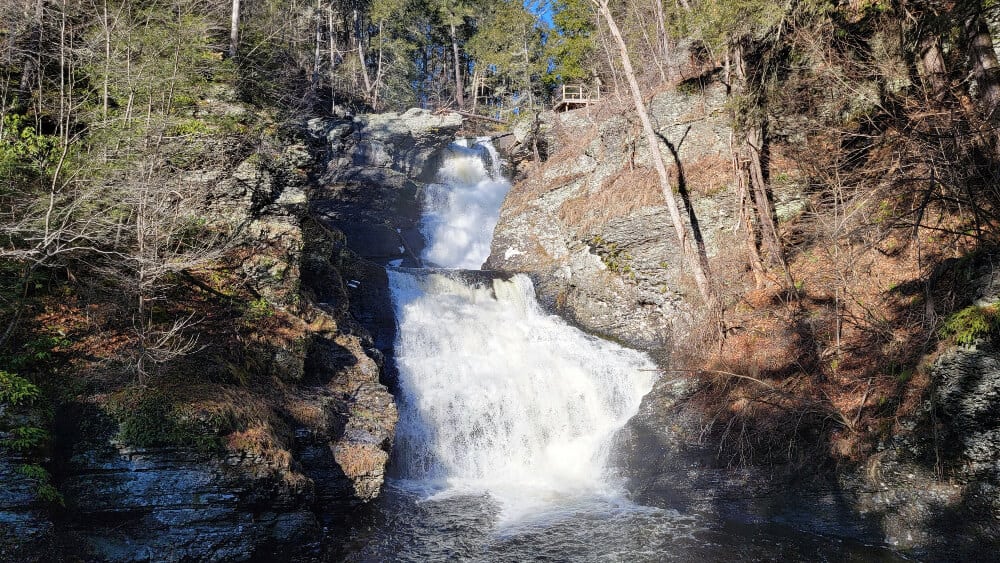
Raymondskill Creek Trail
- Trail Location: 41.29032969955007, -74.8401325501427 on Raymondskill Road in Milford, PA
- Trail Length: .3-mile loop
- Trail Difficulty: Moderate – The trail is flat in spots but steep in some sections and includes stairs (wooden and stone) to the viewing platforms
- Elevation Gain: 180 feet
- Dog Friendly: No
Even though the hike to Pennsylvania’s tallest waterfall is only a .3-mile loop, it still requires a bit of effort thanks to the steps to both the lower and top viewing platforms.
Raymondskill Creek Trail is open year-round, but it can be very icy and slippery in the winter months. Also, the upper parking lot is closed from January through mid-April.
Raymondskill Falls is a very popular waterfall trail in the Delaware Water Gap, so if you plan on hiking during the summer and fall months, you’ll want to arrive early on the weekends. Though it would be best to visit during the week instead!
Hackers Trail
- Trail Location: 41.29032969955007, -74.8401325501427 on Raymondskill Road in Milford, PA
- Trail Length: 2.8 miles (out and back)
- Trail Difficult: Moderate – The trail is steep in sections but mostly easy
- Elevation Gain: 340 feet
- Dog Friendly: Yes
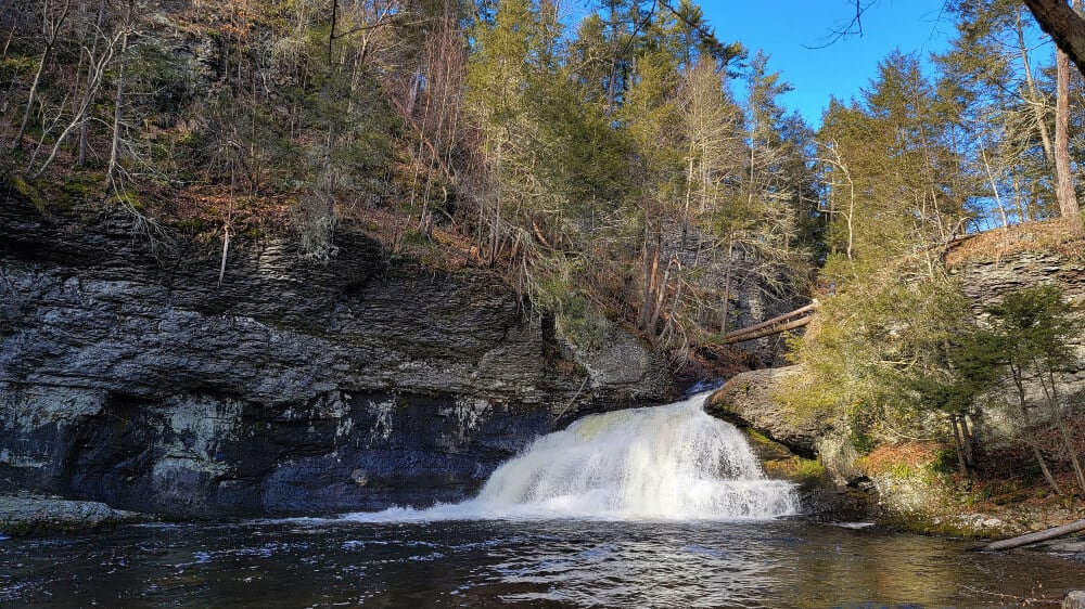
This is such a great hike in the Delaware Water Gap National Recreation Area.
The Hackers Trail hike is a moderate trail that leads you to a beautiful waterfall. It’s just about 1 mile to the waterfall from the parking lot.
However, the trail continues until it intersects with the Buchanan Trail. You can treat the trail as an out-and-back, or loop it with the Buchanan Trail and the Cliff Trail (keep in mind, sections of the Cliff Trail close for a short time in the summer due to peregrine falcon nesting).
Mount Minsi on the Appalachian Trail
- Trail Location: Lake Road in Delaware Water Gap
- Trail Length: 5 mile loop
- Trail Difficult: Harder side of moderate
- Elevation Gain: 1100 feet
- Dog Friendly: Yes
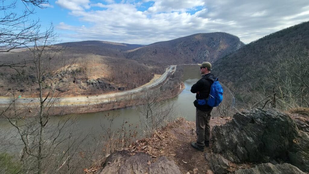
The trail to the Mount Minsi south overlook is one of the best sections of the Appalachian Trail in Pennsylvania. It features various viewpoints along the way, and then a great view of the Delaware River at the top, before you head back down Lake Road.
You can treat the trail as an out-and-back, instead of a loop. Or you can shorten the trail to the first overlook, which is about 1.3 miles one way, or 2.6 miles out and back.
This trail is the sister trail to the Mount Tammany Red Dot trail, since you can see Mount Tammany from the top of Mount Minsi and vice versa.
Sunfish Pond via Douglas Trail and Garvey Springs Trails
- Trail Location: Across the street from the Douglas Parking lot on Old Mine Road
- Trail Length: 4.4 miles loop
- Trail Difficult: Hard due to steep grade and very rocky trail in sections.
- Elevation Gain: 1100 feet
- Dog Friendly: Yes
This is one of my favorites hikes in the Delaware Water Gap. It’s very challenging to start, thanks to the steep incline of the Garvey Springs Trail. But the payoff is worth it!
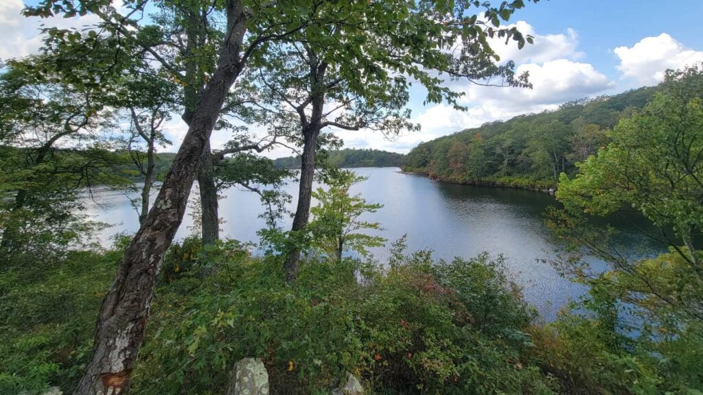
Sunfish Pond is the southernmost glacial lake along the Appalachian Trail. The 44-acre pond is a National Natural Landmark and considered one of the Natural Wonders of New Jersey.
To get to the pond, take the Garvey Spring Trail to the Appalachian Trail. Then you’ll follow the Appalachian Trail to the southern part of the lake (it’s very rocky!), eventually connecting with the Douglas Trail to return.
Mount Tammany Red Dot Trail
- Trail Location: Dunnfield Creek Appalachian Trail exit on I-80 West, in Knowlton Township, NJ
- Trail Length: 4 mile loop
- Trail Difficult: Hard due to steep grade and very rocky trail in sections.
- Elevation Gain: 1230 feet
- Dog Friendly: Yes
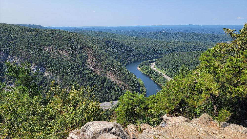
The Mount Tammany Red Dot Trail is probably one of the most popular hikes in the Delaware Water Gap, and for good reason! It’s a tough climb to the overlook, but the views are incredible.
One thing to note about this trail is that it is very popular. If you want to hike this trail on the weekend in the summer or fall, you’d better arrive early (or maybe in the evening, as it could be a fun sunset hike).
You can treat this trail as an out-and-back, making it about 3 miles. Or connect to the Blue Trail to loop around, increasing the length to 4 miles.
Be prepared for a steep trail with some rock scrambles. It’s not an easy trail, so if you’re not a seasoned hiker, you might prefer the Mount Minsi Trail across the river instead.
Other Hikes Near the Delaware Water Gap
Northeastern Pennsylvania has many beautiful hiking trails, and some are very close to the Delaware Water Gap. One of the more popular locations is Bushkill Falls, which offers multiple trails past several waterfalls. Another fun trail is a section of the Appalachian Trail to Wolf Rocks.
Of course, if you love waterfall trails, the George W. Childs Park hike is a short drive from a few of the hikes on this list and is less than 2 miles long, making it a great addition to your time in the DWG.
Pin It For Later