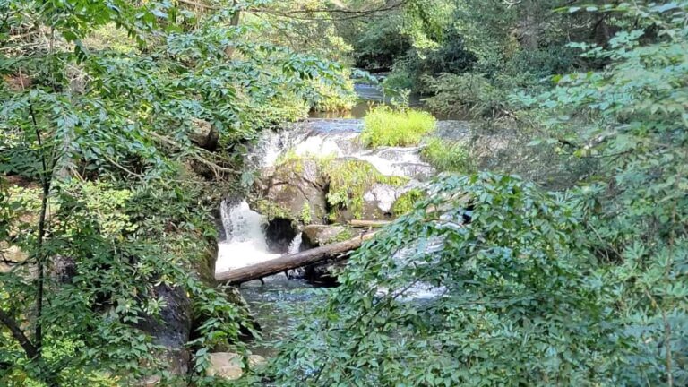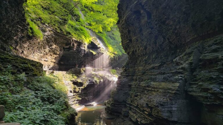
Kentucky’s Red River Gorge Geological Area has more than 100 natural arches. It’s the greatest concentration of arches east of the Rocky Mountains!
Although we’d love to hike to each and every one of them, there isn’t enough time for that. So instead, we put together some of the best hikes in the Red River Gorge for families that will lead to these natural wonders.
Many trails in the Red River Gorge are short, so you can combine several of them and do many in one day. We spent about 2 1/2 days in the Red River Gorge and were able to fit in all of the trails listed below. And that was with resting mid-day (because it was so hot!).
If you only have time for one or two trails, our favorites were the Original Trail to the Natural Bridge at Natural Bridge Resort State Park and Grays Arch Trail in Daniel Boone National Forest.
In this day and age, I feel the need to mention that I don’t use AI to write my posts!
I’ve hiked these trails, taken these photos, and collected this information personally (sometimes with the help of my friends, who are also real, live people). I appreciate you being here and utilizing my work for your future endeavors.
Also: Some of the links below are affiliate links, meaning that, at no additional cost to you, I may receive a commission if you click through and make a purchase.
Thank you for your support!
Prepare For Your Family Hike in Red River Gorge
Dangerous Cliffs
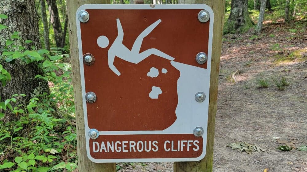
There are some fantastic trails in Red River Gorge that are perfect for families. However, some of these hikes lead to the top of tall arches and cliff overlooks with no guards or railings. It’s best to keep your kids away from the edges and within arm’s reach if there are small.
Limited Cell Service
We were lucky on during our hikes in Red River Gorge that we only lost cell service occasionally. However, there is a still a chance you won’t have cell phone coverage on your hike, so it’s best practice to download a map before you start.
Wildlife
Red River Gorge is home to many species of wildlife and that includes the occasional black bear and poisonous snakes. Always be aware of your surroundings and watch out for the wildlife.
Pets
Pets are allowed on the trails in Daniel Boone National Forest. They are not allowed on any of the Natural Bridge State Resort Park trails, with the exception of Henson Arch and Whittleton Trails.
Pack the Essentials
Red River Gorge is pretty remote, so make sure you have everything you need before you head out on your hike, including first-aid kits, snacks, and water.
Be a Responsible Visitor
Trails in Red River Gorge are popular with visitors, which can bring trash and other issues. We all need to do our part to keep our parks clean and enjoyable for all.
Remember to pack out all trash (including those fruit peels), and leave behind what you found. Leave no trace so we all can enjoy these parks for years to come.
10 Best Hikes in Red River Gorge for Families
Inside Daniel Boone National Forest
Sky Bridge Loop
- Trail Location: Sky Bridge Road in Daniel Boone National Forest (Trail #214)
- Trail Length: .75-miles
- Trail Difficulty: Moderate due to the number of stairs
The Sky Bridge Loop is a very popular trail in Red River Gorge. At 3/4-mile, it’s relatively short and can be done quickly.
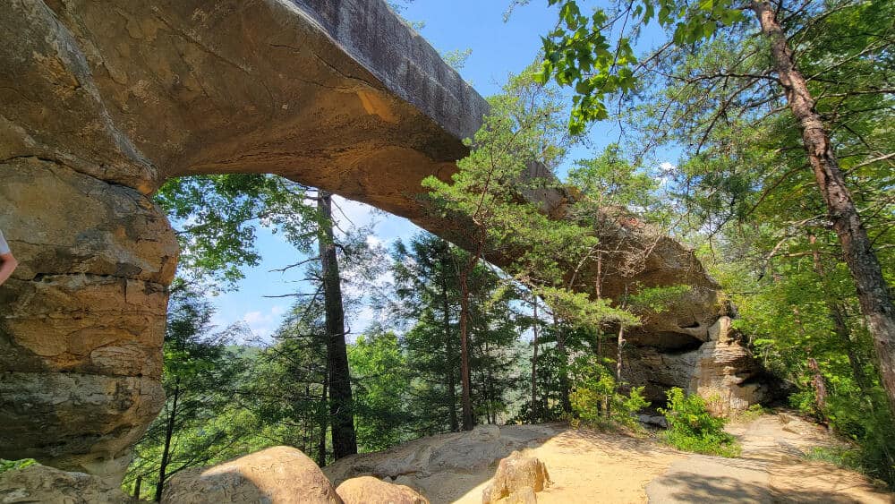
This is an excellent hike in Red River Gorge for families because it isn’t too difficult (there are a lot of stairs, but otherwise, it’s a relatively easy trail).
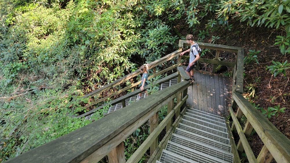
We recommend heading to the bottom of the arch first. There are a lot of stairs, and it’s easier to go down them at the beginning than up at the end.
Then you can end your hike with views of the Red River Gorge from the top of the Sky Bridge.
Visitor Tip: If you have a family member who has difficulty climbing stairs, you can walk directly to the top of the Sky Bridge Arch via a paved path onto the natural stone arch.
The Sky Bridge Arch is one of the more prominent arches in Daniel Boone National Forest. It’s 75 feet long and 23 feet high and provides lovely shade and shelter for a snack.
After visiting below the arch, follow the trail to the point where you’ll have a beautiful overlook. From there, stone steps will take you to the top of the Sky Bridge.
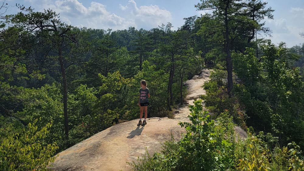
The trail continues along the top of the arch to a paved path that leads back to the parking lot.
Whistling Arch
- Trail Location: Fd-1007 via Sky Bridge Road in Daniel Boone National Forest (Trail #234)
- Trail Length: .5-miles out-and-back
- Trail Difficulty: Easy
As one of the shortest hikes in Red River Gorge, it’s easy to combine with one of the many other arches in the area. We combined it with the Sky Bridge Loop since they are a short drive from each other.
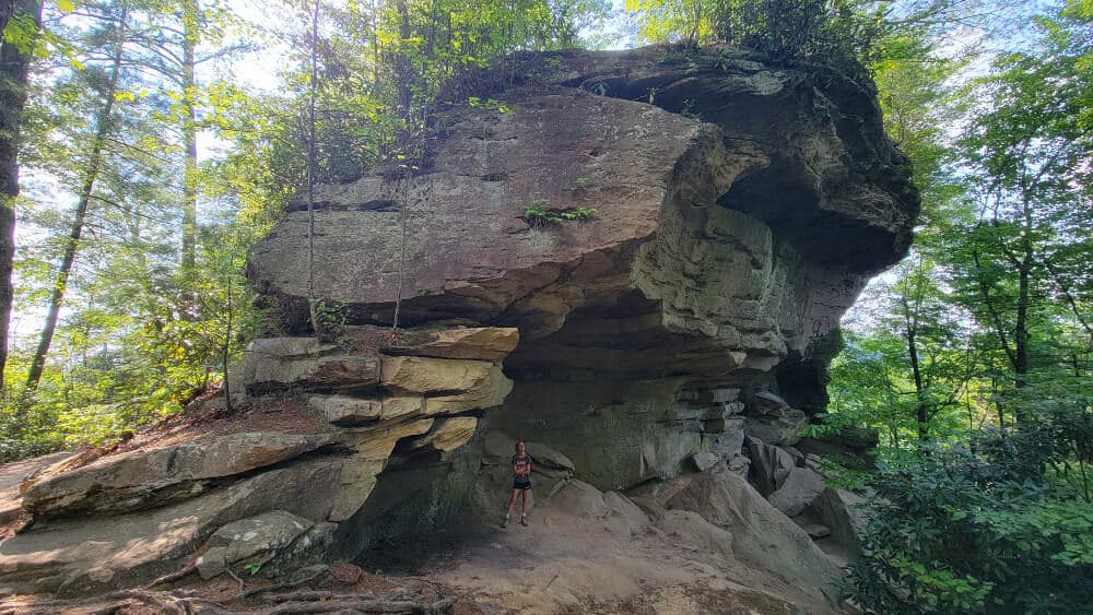
The trail slightly descends to the arch, with many rocks and roots to navigate. There is also a small campsite off the path so that you might see a tent set up.
Whistling Arch is a smaller arch (about 4 feet high), but it is still enjoyable to see. Kids might enjoy climbing around the base of the arch.
If you continue just past the arch a few hundred feet, you’ll come to a beautiful cliff overlook. It’s worth the extra steps for the view!
Princess Arch
- Trail Location: Chimney Top Rock Road in Daniel Boone National Forest (Trail #233)
- Trail Length: .5-miles out-and-back to bottom of arch; 1 mile out-and-back to top of arch
- Trail Difficulty: Easy
The Princess Arch Trail is another short and sweet hike in the Red River Gorge. It’s perfect to combine with the Chimney Top Trail, as both are accessed from the same parking area.
If you only hike to the bottom of the arch, it’s a .5 miles out and back. The trail is pretty easy, with a slight descent.
At 32 feet across, Princess Arch is one of the smaller arches in the Daniel Boone National Forest, but still beautiful in its own right.
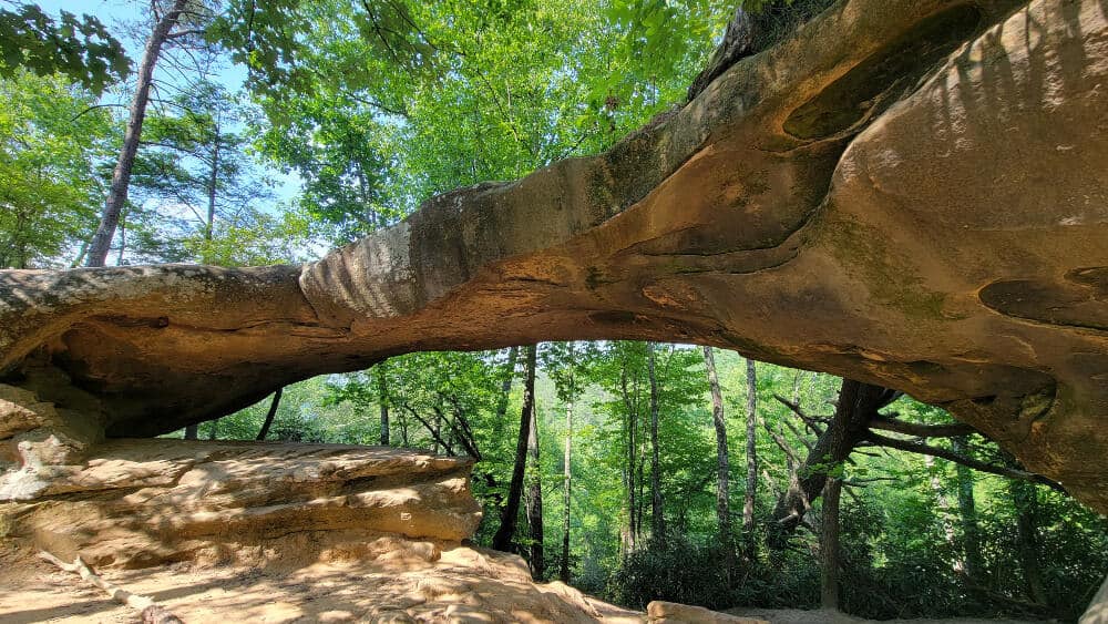
You can continue on the trail to the top of the arch, adding another .5-miles to the length. There are some points along that trail where you can see the gorge through the trees.
Visitor Tip: To access the parking area for the Princess Arch and Chimney Top trails, you’ll have to drive 3.5 miles of unpaved road. There are several potholes and bumps along the road, so keep that in mind when choosing your vehicle for your trip!
Chimney Top
- Trail Location: Chimney Top Rock Road in Daniel Boone National Forest (Trail #235)
- Trail Length: .75-miles out-and-back
- Trail Difficulty: Easy
Chimney Top Trail leads to a fantastic overlook 400 feet above the Red River, giving visitors a good perspective of how the area was formed.
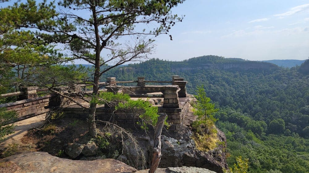
This easy trail is about .75-miles out and back. The path is paved for about half the course. The other half is relatively flat, with occasional rocks and roots to navigate.
It’s not a wheelchair-friendly trail, but you might be able to use a stroller along the path that can handle some off-roading.
From the overlook, you can see parts of the Red River to your right and Half Moon Rock to your left. Chimney Top Rock is also a great place to catch the sunset. It’s one of the best things to do in Red River Gorge!
Grays Arch
- Trail Location: Grays Arch Picnic Area via Tunnel Ridge Road in Daniel Boone National Forest (Trail #205)
- Trail Length: 2 miles, out and back
- Trail Difficulty: Moderate due to stairs and steep incline closer to the arch
Grays Arch is one of the largest arches in Red River Gorge (and the largest one on this list!). The arch spans 80 feet across and is 50 feet high.
The trail starts at the Grays Arch picnic area, which has picnic tables and vault toilets at the trailhead. This is a popular area, so if you plan to hike on a weekend, arrive early or later in the day.

The Grays Arch trail is about 2 miles, out and back. You can combine it with the Rough Trail and Rush Ridge Trail to make a longer loop.
The trail is pretty flat and easy for the first half of the trail, although there is a slight descent with rocks and roots to navigate.
However, the trail becomes more moderate to difficult once you reach the stairs. There are multiple staircases down to the bottom of the trail.

Once at the bottom, you might see a waterfall to your right. However, you’ll definitely see Grays Arch up towards your left!
At that point, the trail is a bit of a scramble up the rocks, but it’ll bring you directly underneath the arch.
This was one of my favorite hikes in Red River Gorge due to the size and scale of the rocks and arch. You’ll never feel so small!
Visitor Tip: To access the Grays Arch Picnic Area, you’ll have to drive along a one-mile-long unpaved road. There are several pot holes and bumps along the road.
Rock Bridge
- Trail Location: Rock Bridge Picnic Area via Rock Bridge Road in Daniel Boone National Forrest (Trail #207)
- Trail Length: 1.5-mile loop
- Trail Difficulty: Moderate
Only one arch in Red River Gorge crosses over the water, and that is the Rock Bridge! We loved this trail because it also leads to a waterfall.
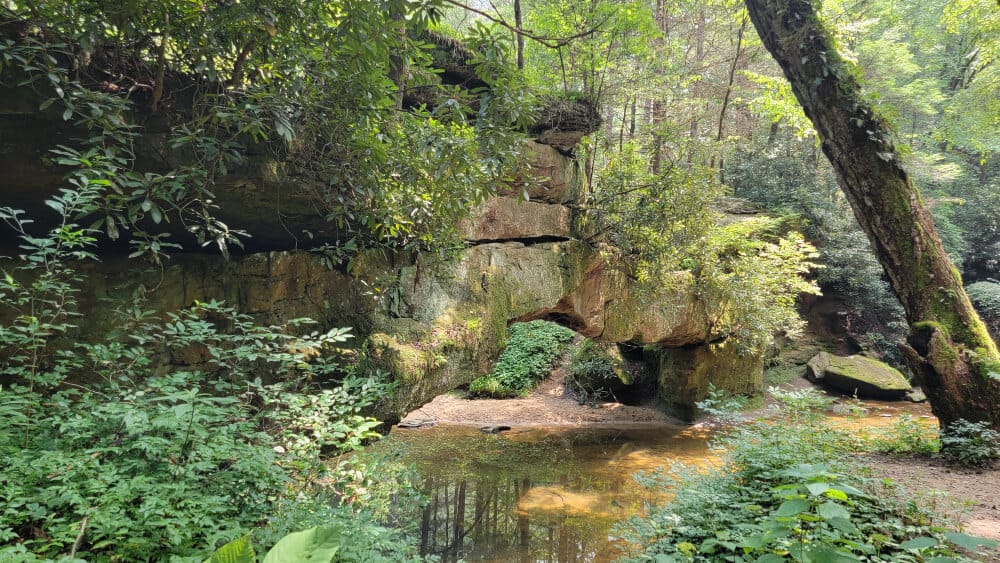
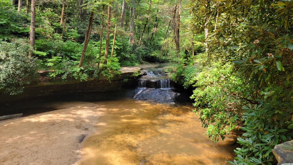
Creation Falls, a small waterfall right before Swift Camp Creek, draws many visitors to this fun Red River Gorge hike.
At the base of Creation Falls is a small natural pool (not too deep) that visitors like to wade in to cool off on a hot day. It’s a fun thing to do in Red River Gorge!
Its sandy beach is perfect for sitting and enjoying a snack or lunch. Remember to carry out all of your trash!
The Rock Bridge Trail is on the easy side of moderate in difficulty.
We recommend going counterclockwise on the trail to start with stairs and do a more gradual ascent at the end of the loop. Plus, the Rock Bridge and waterfall are closer to the end of the loop, so you’ll have a shorter walk back to the parking lot.
This is another popular trail, and the parking lot fills up quickly, especially at midday when visitors want to enjoy the cool water at the waterfall’s base. Arrive early or much later in the day for easy parking and a quieter hiker.
Visitor Tip: The parking area for Rock Bridge Trail is at the end of a 3-mile-long unpaved road. There are several pot holes and bumps along the road, so keep that in mind when choosing your vehicle for your trip!
Inside Natural Bridge State Resort Park
Original Trail
- Trail Location: Next to the gift shop and parking lot by the Swinging Bridge at Natural Bridge State Resort Park
- Trail Length: .75 miles to the base of the Natural Bridge arch
- Trail Difficulty: Moderate
The Original Trail at Natural Bridge State Resort Park is the shortest way to get to the base of the arch.
The trailhead is accessed by the gift shop and offers a steady ascent up wooden and stone steps along the way. The trail isn’t too difficult, but it would be considered moderate due to the incline.
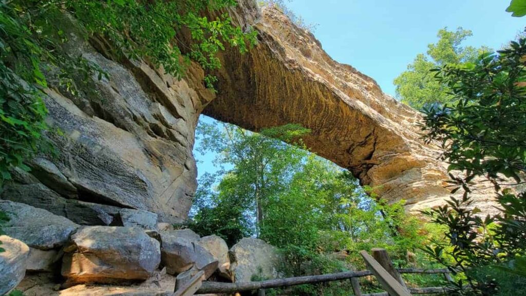
There are several places to rest along the trail, including a few shelters that were built in the 1930s.
Once you reach the base of the arch, follow around the other side to the narrow stone steps. These will lead you to the top of the arch to join the Laurel Ridge Trail (see more info below).
Laurel Ridge Trail
- Trail Location: On top of Natural Bridge at Natural Bridge State Resort Park
- Trail Length: .75 miles from top of the arch to Lover’s Leap
- Trail Difficulty: Easy
Once you are on top of the Natural Bridge arch, you’ll want to take the Laurel Ridge Trail to get some of the best views of the area and the arch itself!
The Laurel Ridge Trail is mostly flat and easy. It leads across the arch to the Sky Lift (another option to get to the top of the arch).
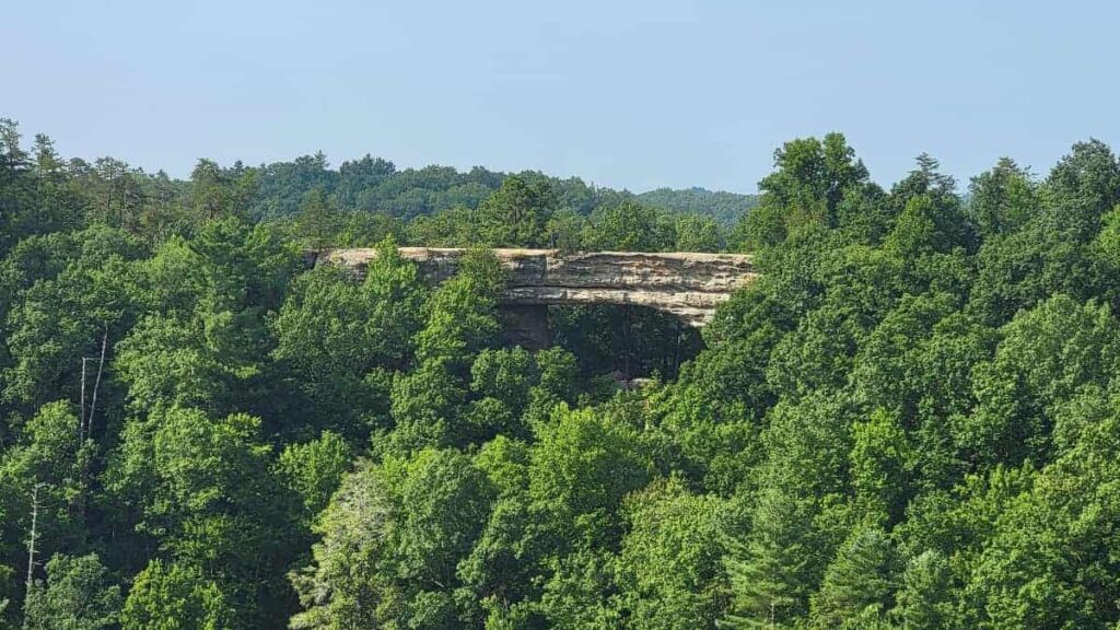
Continue to follow the trail until you reach an outcropping. This is the Natural Bridge Overlook. Seeing it after you’ve been on top of it is incredible!
You can continue the trail to Lover’s Leap for more beautiful views. However, you have a few options if you want to return to the Hemlock Lodge or parking area.
First, you can climb down the very steep steps at Needle’s Eye or the Devil’s Gulch. Both of these could be difficult to do with young children.

From here, you’ll connect to the Battleship Rock Trail (see more info below).
The other option is to walk back down to the bottom of the arch. Then you can return to the parking lot via the Original Trail or by taking the Balanced Rock Trail.
Battleship Rock Trail
- Trail Location: Behind Hemlock Lodge at Natural Bridge State Resort Park
- Trail Length: .75 miles
- Trail Difficulty: Moderate
Battleship Rock Trail is an alternate trail to reach Natural Bridge’s base or return to the parking lot from the arch.
The trail is .75-miles in length. However, you can cut it short by combining it with other routes.
For example, on our visit to Natural Bridge State Resort Park, we took the Devil’s Gulch down from Laurel Ridge Trail and followed Battleship Rock back to the Original Trail before returning to the parking lot.
Battleship Rock Trail has some incline until you reach Devil’s Gulch; from there, the trail is relatively flat, with roots and rocks to navigate until you get to the Original Trail.
Henson Arch
- Trail Location: Whittleton Campground at Natural Bridge State Resort Park (just past the bathhouse)
- Trail Length: .5 miles out and back
- Trail Difficulty: Moderate
Henson Arch Trail is one of the shortest hikes in the Red River Gorge, but it is still worth doing.
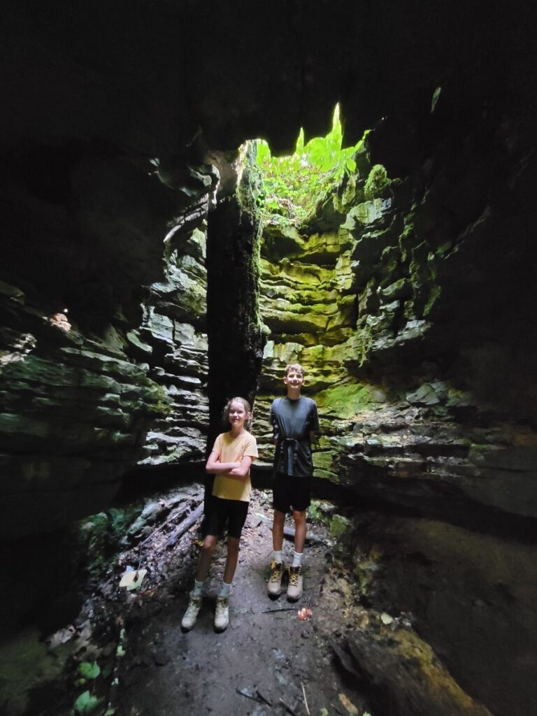
This .5-mile out-and-back trail heads up a steady incline to a small arch in a grotto/cave. As a bonus, there is also a small waterfall in the cave!
To access the trailhead, enter the campground and park near the check-in station. From there, it’s a short walk past the bathhouse to the trail.
The trail is short but steep in some sections. However, as you get closer to the arch and waterfall, it starts to level off.

Once you reach the grotto, take the ladder-style staircase down to the bottom. Be careful. The steps might be wet from the spray.
Good to Know: Due to the grade and makeup of the trail, it can be very slippery after rain.
At the bottom, look up! You can see how it’s actually an arch, not just a hole in the ground. And you’ll get a better look at the waterfall.
Best Hikes in Red River Gorge Wrap-Up
We loved hiking in Red River Gorge! The unique landscaping, partnered with the gorgeous natural arches, makes for some fun trails.
And there are plenty of other things to do in Red River Gorge to keep you and your family busy during your visit, like rock climbing, off-roading, and boating through an underground mine.
Pin It For Later