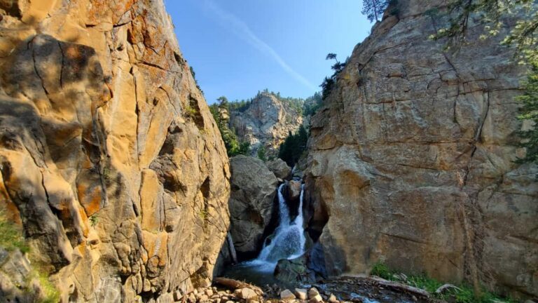
As the nation’s capital, Washington, DC, is a bustling metropolis. Even though there is plenty of green space in the city, like the National Mall and the National Arboretum, it’s always nice to escape craziness.
Thankfully, Washington, DC, is close to beautiful hikes in Maryland, Virginia, and West Virginia. Most of the hikes below are two hours or less from Washington, DC, though some are a bit further, but worth the drive!
The guide below shares some of the best hiking trails near DC that can be done on a day trip or overnight. So, let’s dive in!
Disclosure: Some of the links below are affiliate links, meaning, at no additional cost to you, we may receive a commission if you click through and make a purchase.
Be a Responsible Visitor
Remember as you visit the places below to respect nature. Stay on established paths, pack out your trash (including food waste), and leave what you find behind.
The more popular these destinations become, the more we need to be diligent about keeping our parks and lands clean and safe for all. You can learn more here.
17 Awesome Hikes Near Washington DC
1. Billy Goat Trail at C&O Canal National Park
Approximately 15 miles and 30 minutes from Washington, DC
- Trail Location: Milepost 13.8 on the Chesapeake-Ohio Canal Towpath
- Trail Length: Billy Goat Trail Section A is about 1.75-miles long (one-way). However, the trailhead is .7-miles from the Great Falls parking lot.
- Trail Difficulty: Moderate-Hard depending on hiking experience
- Fees: $20 to enter the C&O Canal National Historical Park parking lot or you can use your National Park Pass
- Dog Friendly: No (dogs are allowed in the park, but not on the Billy Goat Trail
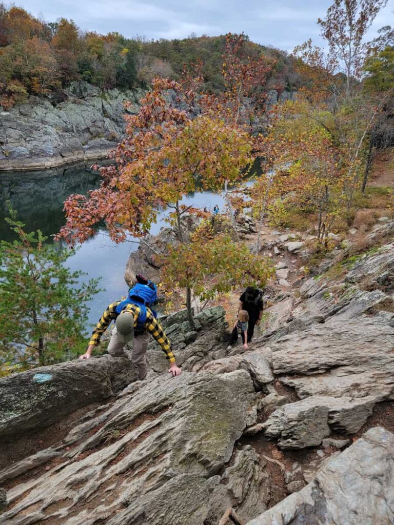
The Billy Goat Trail Section A in C&O Canal National Historical Park is the closest hike near DC on this list. It’s a fun but challenging 1.75-mile trail, one way. However, you have to walk .7 miles from the parking lot to reach the trailhead.
The National Park Service considers the trail difficult due to its numerous rock scrambles and the 50-foot ascent up a cliff face. Because of the rocks and climb, dogs are not allowed on the trail.
You’ll be treated to a beautiful view of the Potomac River as you complete the trail. You might even spot some rockclimbers across the river!
It’ll take about 1.5-2 hours to complete the trail and the walk to and from the parking area. For more to do in the park, check out the easy Olmstead Island Bridges trail to the Great Falls overlook.
2. Northern Peaks Trail at Sugarloaf Mountain
Approximately 40 miles and 1 hour from Washington, DC
- Trail Location: West View Parking Lot
- Trail Length: About 5 miles (loop trail)
- Trail Difficulty: Moderate
- Fees: None
- Dog Friendly: Yes
Sugarloaf Mountain is a privately owned non-profit park that is open daily from 8 am until 4 pm, so plan your drive from DC accordingly!
Sugarloaf has several trails, but the most popular is the Northern Peaks Trail, also known as the Blue Trail. It’s a 5-mile loop that leads to the beautiful White Rocks overlook at just under 1300 feet in elevation.
The trail is steep in sections and follows the mountain’s topography. By combining the hike with the other available trails, you can shorten or extend the trek to the summit. Remember, the Yellow Trail allows horses, so you may encounter some droppings along the route.
3. Appalachian Trail to Ravens Rocks
Approximately 60 miles and 1 hour from Washington, DC
- Trail Location: Ravens Rocks Trailhead Parking in Bluemont, VA
- Trail Length: About 5.7 miles (out-and-back)
- Trail Difficulty: Hard– a lot of up and down and steep in some sections
- Fees: None
- Dog Friendly: Yes
Another great hike about an hour from Washington, DC, is the Appalachian Trail to Ravens Rocks. It’s located in Bluemont, Virginia, near the West Virginia border. From the summit, the hike offers excellent views of the Shenandoah Valley.
This moderate to strenuous trail, known locally as the “roller coaster” since it winds up and down several ridges, is 5.7 miles out and back and features very rocky terrain and some steep sections. You’ll definitely want to wear hiking boots for this trail and maybe use hiking poles.
The parking area for Ravens Rocks is small and only holds a handful of cars, so you’ll want to arrive early on weekends or try hiking during the week.
4. Appalachian Trail to Annapolis Rock
Approximately 60 miles and 1.25 hours from Washington, DC
- Trail Location: Trailhead is at the back of the parking area on Baltimore National Pike in, Myersville, Maryland
- Trail Length: 4.4 miles (out-and-back)
- Trail Difficulty: Moderate
- Fees: None
- Dog Friendly: Yes
Another fantastic hike near DC that follows the Appalachian Trail is Annapolis Rock in Boonsboro, MD. This popular trail is about 4.5 miles out and back and leads to a gorgeous overlook of the Cumberland Valley.
The trail is relatively moderate, with many wood steps. It offers incredible views and is the perfect hike for families, new hikers, and anyone who enjoys being outdoors.
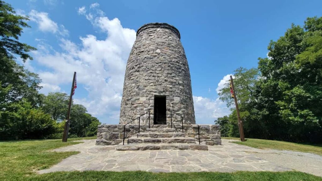
While in Boonsboro, drive to Washington Monument State Park, where you can complete an easy half-mile trail to the original Washington Monument.
5. Wolf Rock & Chimney Rock at Catoctin Mountain Park
Approximately 60 miles and 1.25 hours from Washington, DC
- Trail Location: At the back end of the Catoctin Mountain Visitor Center Parking Lot
- Trail Length: 3.8 miles
- Trail Difficulty: Moderate
- Fees: None
- Dog Friendly: Sort of (dogs are allowed on the trails but not on the rock formations)
The hike to Wolf Rock and Chimney Rock in Catoctin Mountain Park is a very popular trail. The parking area can fill up by 9 am on weekends! But it’s a beautiful rocky trail that leads to two pretty outcroppings.
Most hikers recommend you take the trail clockwise due to its steepness. It would be beneficial to use hiking poles on this trek.
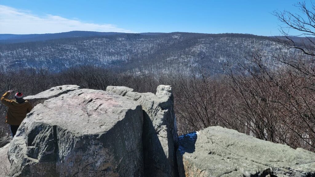
Once you’re at the top of the ridge, the trail evens out a bit and slowly descends to Wolf Rock. You can scramble up the rocks for a beautiful view and a rest break. Afterward, continue to Chimney Rock, about another 1/2-mile, for even more views.
You can extend this hike by combining it with the hike to Cunningham Falls. More info about that is below.
6. Cunningham Falls Nature Trail at Catoctin Mountain Park
Approximately 60 miles and 1.25 hours from Washington, DC
- Trail Location: Gravel parking lot at the Catoctin Mountain Park Visitor Center
- Trail Length: 2.8 miles, out-and-back
- Trail Difficulty: Easy side of moderate
- Fees: None
- Dog Friendly: Yes
The Cunningham Falls Nature Trail in Catoctin Mountain Park leads to Maryland’s tallest waterfall. It’s an extremely popular trail, so you’ll want to arrive early in the morning or much later in the day. The parking lot can fill up by 9 am on weekends.
The hike features an elevation gain of 325 feet over the first mile but then levels out as you approach the falls. This hike is best in early spring when the falls are at their fullest from snow melt.
You can access the falls via the Lower Trail at Cunningham Falls State Park, an easy 1-mile out-and-back. However, you’ll have to pay an entrance fee of up to $7/person, depending on the time of year.
7. Maryland Heights Trail
Approximately 60 miles and 1.25 hours from Washington, DC
- Trail Location: The trail begins in Harpers Ferry, crossing the Potomac via the train bridge
- Trail Length: About 4.5 miles (out-and-back)
- Trail Difficulty: Strenuous – A large chunk of the trail is on a steep grade, either uphill or downhill. Consider using hiking poles for this hike.
- Fees: $20 to park at the Harpers Ferry National Historical Park parking lot. You can also use your National Park Pass.
- Dog Friendly: Yes
The Maryland Heights trail is one of Harpers Ferry’s most favored hiking routes. It offers visitors breathtaking views of the Potomac and Shenandoah rivers and Harpers Ferry. It’s also one of the best places for hiking as a family on the East Coast.
The hike begins in Harpers Ferry, where you’ll cross the Potomac River and then follow the C&O Canal towpath to the trailhead for Maryland Heights. Along the way, you’ll find several rest stops with benches and water fountains, making the journey more comfortable.
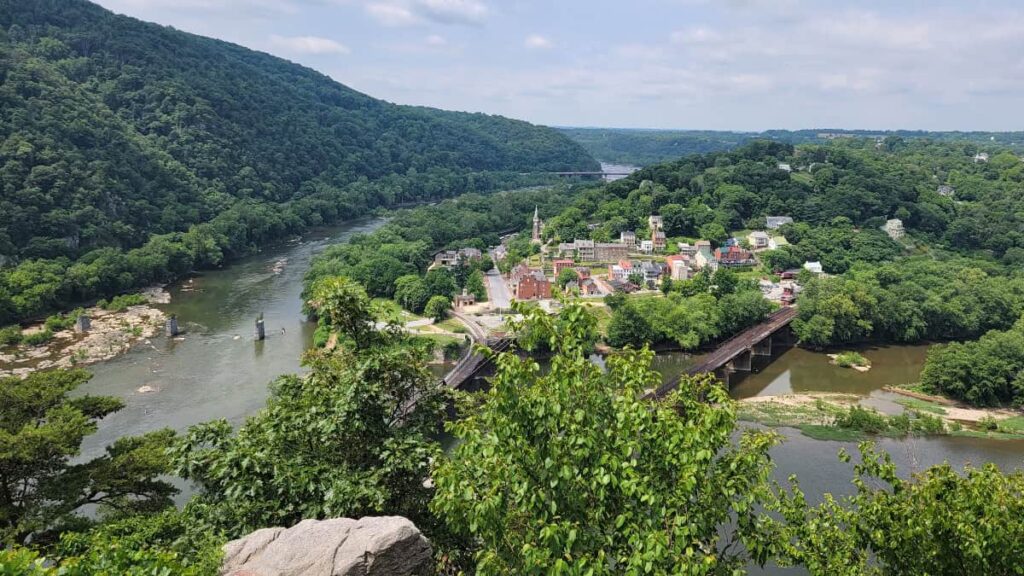
The trail’s predominant feature is its steepness, with few sections offering level ground. This makes it a moderately challenging hike, so it’s not recommended for beginners. Hiking poles are recommended due to the challenging terrain. The Maryland Heights overlook offers ample space for visitors to sit, relax, and enjoy stunning panoramic views.
If you want to do the Maryland Heights trail, plan for it to take 2.5 to 3 hours to complete the trail and leave some time to enjoy the view. This trail is close to the easier and shorter Weverton Cliffs.
8. King & Queen Seat at Rocks State Park
Approximately 75 miles and 1.5 hours from Washington, DC
- Trail Location: The Rocks State Park Rocks Ridge Picnic Area entrance is off St. Clair Bridge Road in Jarrettsville, MD. From there, you can easily access the Orange and Red trails, which will lead you to the White trail loop.
- Trail Length: The White loop is about 3 miles long
- Trail Difficulty: Moderate
- Fees: Up to $5 per person
- Dog Friendly: Yes
This picturesque state park is located in Maryland and offers an enjoyable and family-friendly hiking experience. It is conveniently situated within a two-hour drive from Washington, DC.
The White Trail forms a 3-mile loop and encircles the park moderately in difficulty with occasional steep sections. It will bring you past the King and Queen Seat, a beautiful rock outcrop that overlooks Rocks Road and Deer Creek. These formations are fun to climb on and explore.
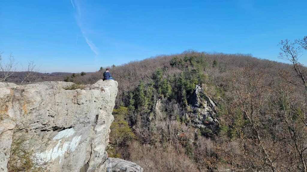
If you’d like a shorter and easier path to the rocks, take the red trail from the parking lot.
You can combine this trail with the Kilgore Falls Trail to make it worth the drive from DC (see below).
9. Kilgore Falls at Rocks State Park
Approximately 75 miles and 1.5 hours from Washington, DC
- Trail Location: 1026 Falling Branch Rd, Pylesville, MD 21132. The trailhead is at the back of the parking lot.
- Trail Length: 1.4 mile total out-and-back
- Trail Difficulty: Easy
- Fees: Up to $5 per person (Reservations are required weekends Memorial Day through Labor Day)
- Dog Friendly: Yes
This waterfall trail is about 90 minutes from Washington, DC, and is fun for everyone.
The trail leading to Kilgore Falls is very popular. So much so that you need a reservation if you are visiting weekends from Memorial Day through Labor Day.
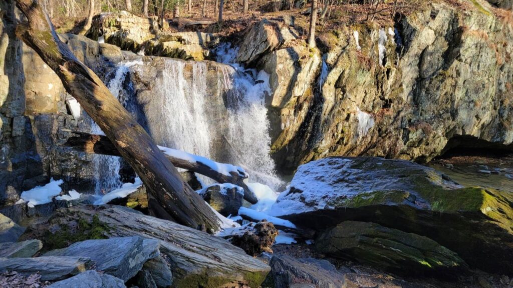
It’s an easy 1.4-mile out-and-back trail that leads to Maryland’s second-tallest waterfall. It’s a perfect addition to the King & Queen Seat trail that’s a short drive away.
To fully experience the waterfall up close, you’ll have to cross the creek, which requires stepping stones. Wear water-resistant boots or shoes that you don’t mind getting wet.
10. Bluebell Trail at Shenandoah River State Park
Approximately 80 miles and 1.5 hours from Washington, DC
- Trail Location: The trail begins at the end of the parking area on Canoe Launch Road
- Trail Length: 1 mile (You can add on the River Trail for an additional 2.1 miles)
- Trail Difficulty: Easy
- Fees: $10
- Dog Friendly: Yes
Head to Virginia’s Shenandoah River State Park for a fun day trip from Washington, DC. The park offers scenic hiking trails along the winding South Fork of the Shenandoah River. It’s a fun activity in the Shenandoah Valley and is surprisingly close to Shenandoah National Park, another great place to visit.
Shenandoah River State Park boasts over 24 miles of diverse trails, catering to hikers and mountain bikers of all ages. Among the favorites are the popular Bluebell and River Trails, and even a few trails welcome horses. Time your visit for spring, and you might catch the Bluebell Trail adorned with vibrant clusters of Virginia Bluebells.
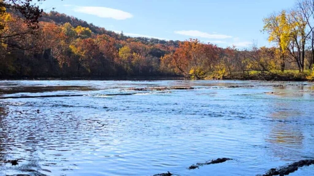
The Bluebell and the River trails have access points to the Shenandoah River and provide great walks with views, sounds, and smells for everyone, including kids and dogs. The river view from Culler’s Overlook, an easy walk from a parking lot soon after entering the park, is not to be missed.
Be sure to stop by the Visitor’s Center before your hike. Talk to the Ranger about current things to do and see, then grab a Nature Bingo sheet or Park-Wide Scavenger Hunt. Kids will also enjoy seeing the displays of local wildlife. There are larger parking areas just past the visitor center. The park offers tent and RV sites, cabin rentals, and even a few yurts!
11. Mary’s Rock at Shenandoah National Park
Approximately 80 miles and 1.75 hours from Washington, DC
- Trail Location: The hike begins at the back of the Panorama parking lot or the Meadow Spring parking area
- Trail Length: 2.7 miles out-and-back from Meadow Spring; 3.7 miles out-and-back from Panorama
- Trail Difficulty: Moderate
- Fees: $15 or you can use your National Park Pass
- Dog Friendly: Yes
Mary’s Rock Trail is a beautiful hike in Shenandoah National Park, only 84 miles from Washington, DC. The hike is quite popular for its summit views at its 3,514-foot peak on both Shenandoah National Park and Massanutten Mountain.
There are two ways to the top. The first hike is 2.7 miles long and starts from the Meadow Springs parking area. The second hike is a bit longer, 3.7 miles in total, and begins from the northern parking lot.
Both offer rewarding views of the park during the trail. Soline from On the Road Diary recommends this fall hike when the tree-lined paths become particularly magical.
These are considered moderate hikes, meaning they require a [fair level of fitness] but are not overly strenuous. They feature some steep climbs at the beginning before it gets easier. They are manageable with children as long as they can climb the rocks. Both trails have great trail signs, and dogs are allowed, but they should be kept on a leash.
12. Old Rag at Shenandoah National Park
Approximately 90 miles and 1.75 hours from Washington, DC
- Trail Location: The trailhead is at the back of the Old Rag Parking Area
- Trail Length: 9.3 miles
- Trail Difficulty: Difficult
- Fees: $15 or you can use your National Park Pass
- Dog Friendly: No
Old Rag is among the most fun and challenging hikes near Washington, DC. Located in Shenandoah National Park, this 9.3-mile trail is the most popular hike in the national park.
This loop trail takes you through a lush green forest, an intense rock scramble, and some steep terrain. The reward is worth it, though, because, at the summit, the endless panoramic views overlooking the hills are incredible.
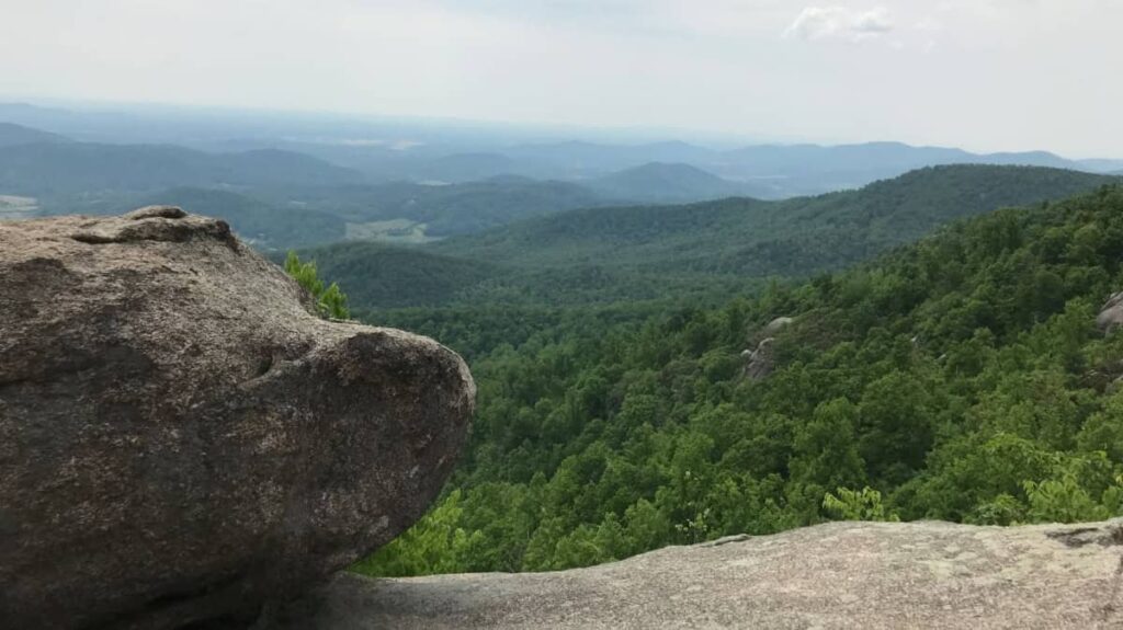
Make sure to come prepared with a lot of water and food. There are no facilities along the Old Rag trail, and it can take 8 hours to complete the entire loop.
Due to the trail’s popularity, you need to reserve a day-use ticket from March through November.
13. Big Schloss at Wolf Gap Recreation Area
Approximately 100 miles and 2 hours from Washington, DC
- Trail Location: The trailhead is on the northwest part of the paved loop at Wolf Gap Recreation area.
- Trail Length: 4.5 miles out-and-back
- Trail Difficulty: It is on the harder side of moderate. The trail is very steep for the first half but then levels out somewhat for the second half to the top.
- Fees: None
- Dogs Allowed: Yes
The trail leading to Big Schloss offers a challenging ascent in its initial half, with a steep grade of up to 23%! However, intermittent “flat” sections along the path provide opportune spots for hikers to rest and catch their breath amidst the demanding climb.
Once you reach the ridgeline, the trail noticeably levels out, offering a more manageable terrain than the first half. Along the ridge, you’ll want to stop and enjoy the scenic views stretching towards Virginia.
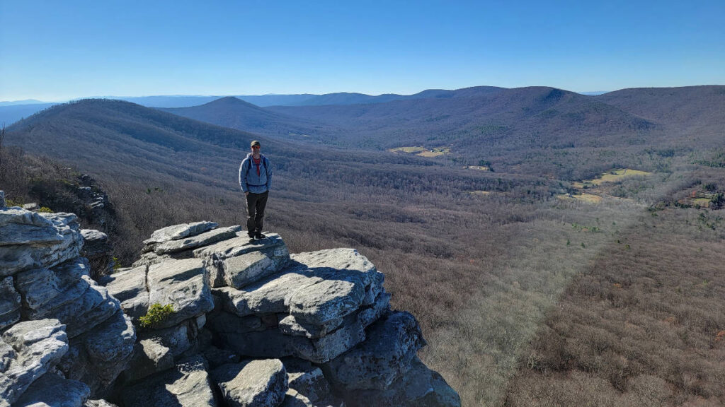
As you continue, you’ll see a sign around the two-mile mark that indicates the start of the Big Schloss Trail. It’s only another quarter-mile to the top, but there are steep sections along this portion. Most hikers complete this trail in about 3- 4 hours, depending on their pace.
As you approach the summit, you’ll find a bridge spanning a chasm that leads you to the top. The summit is surrounded by large boulders that provide gorgeous views of both West Virginia and Virginia. It’s recommended to bring [a good pair of hiking boots and a camera] to enjoy this experience fully.
14. Ice Mountain Preserve
Approximately 105 miles and 2 hours from Washington, DC
- Trail Location: Meet with the guide at Old Mill Inn at Cold Stream and North River Roads
- Trail Length: 1-mile out-and-back
- Trail Difficulty: Moderate
- Fees: None
- Dog Friendly: No (Dogs are prohibited)
Hampshire County is the oldest county in West Virginia. Beyond its historical significance, the area is known for its rich farmland, flowing rivers, and stunning mountainscapes. One of West Virginia’s best-kept secrets and natural wonders lies within these mountains, Ice Mountain.
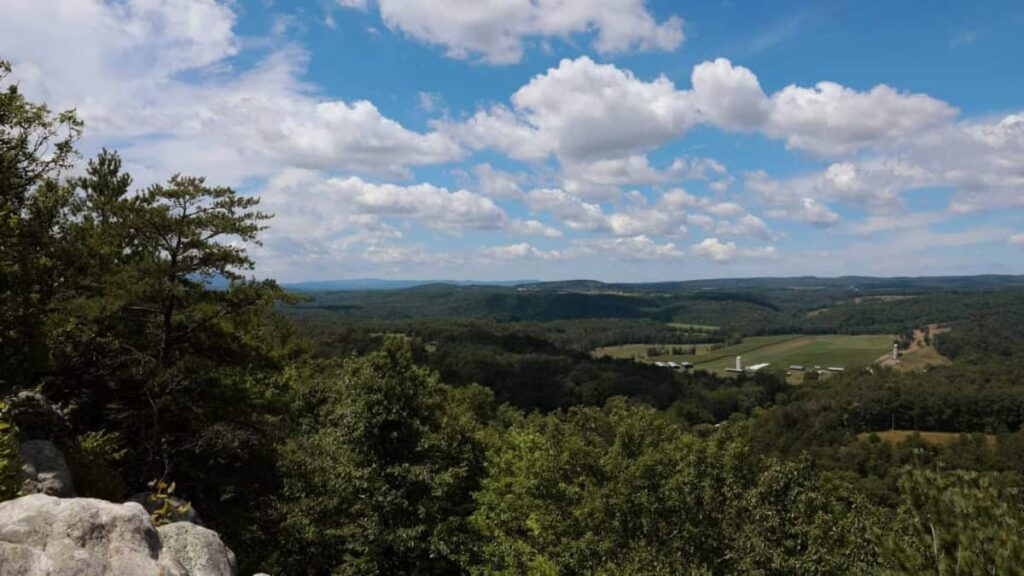
Due to a natural phenomenon, ice can be found on this mountain long after winter has passed. Cold air can be felt year-round, and ice has been found on the mountain as late as June. The hike is approximately a one-mile round trip, but it can be extended to include a visit to the Raven Rocks Overlook.
Ice Mountain has a unique climate and fragile ecosystem. For this reason, the trail is only accessible with a guide. Hikes are usually held on Saturdays, and visitors are asked to make a reservation at least 3 weeks in advance.
15. Dark Hollow Falls at Shenandoah National Park
Approximately 105 miles and 2.5 hours from Washington, DC
- Trail Location: Mile 50.7 on Skyline Drive in Shenandoah National Park
- Trail Length: 1.4-miles out and back
- Trail Difficulty: Moderate
- Fees: $15 or you can use your National Park Pass
- Dog Friendly: No (Dogs are prohibited on the Dark Hollow Falls Trail)
Dark Hollow Falls is a super popular trail in the Shenandoah National Park due to its short length and multiple waterfalls along the trail.
The trail presents an elevation gain of 440 feet over .7 miles, a rather steep incline. As you embark on the trail, you descend the hill on rocky and uneven terrain, leaving the challenging uphill hike for your return journey, adding a sense of adventure to your hike.
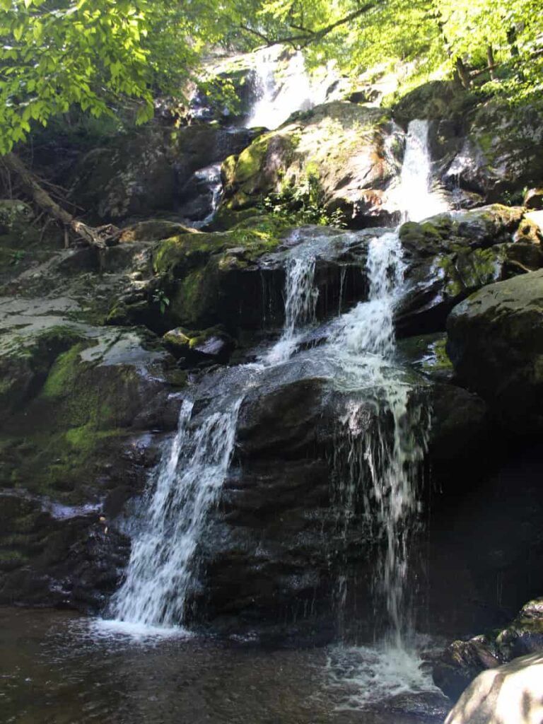
As you hike the trail, you’ll encounter multiple waterfalls. The most impressive one is located about halfway to the bottom. Many hikers choose to stop at this point and return to the parking area, But the true reward lies in reaching the bottom.
If you want to lengthen the trail, you can connect to the Rose River Trail, which leads to another beautiful 67-foot waterfall. The Rose River Trail loop will add 3.8 miles.
16. Cranny Crow Overlook at Lost River State Park
Approximately 130 miles and 2.5 hours from Washington, DC
- Trail Location: The White Oak trailhead is on Dove Hollow Road behind the stables.
- Trail Length: 4 miles out-and-back
- Trail Difficulty: Moderate – it is steep in some sections, but the switchbacks ease the difficulty
- Fees: None
- Dog Friendly: Yes
The White Oak trail to Cranny Crow Overlook is about 2 miles long, with several switchbacks leading up to the Millers Rock Trail.
While sections of the trail are steep, they eventually level out. Since it is a shared-use path, it has numerous rocks and roots to navigate and horse droppings.
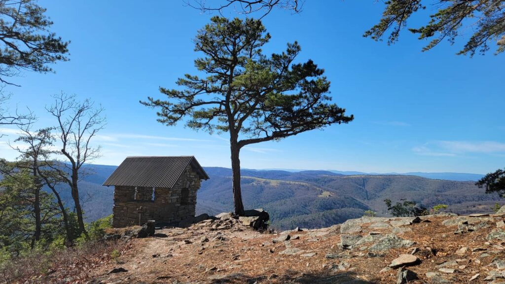
Halfway to the Cranny Crow overlook lies a shelter offering a picturesque view, particularly striking when the trees are bare. This rest spot provides a bench and is ideal for taking a breather, rehydrating, and enjoying a snack.
At the Cranny Crow Overlook, a stone shelter awaits, providing a panoramic view spanning five counties: from Shenandoah County, VA, to Hardy County, WV.
Additionally, visitors will discover the Almost Heaven swings, a West Virginian feature that showcases the state’s most visually captivating spots. The swings invite visitors to capture and share these picturesque scenes on social media platforms.
17. Seneca Rocks
Approximately 160 miles and 3 hours from Washington, DC
- Trail Location: At the Sites Homestead Parking lot in Seneca Rocks, WV (38.835871, -79.372562)
- Trail Length: 3.6 miles out-and-back
- Trail Difficulty: Moderate
- Fees: None
- Dog Friendly: Yes
One of the great things about living in Washington, DC, is the relatively easy access to the Shenandoah and Appalachian Mountains to the west. When you think of the best hikes within a day’s trip from Washington, DC, Seneca Rocks in West Virginia comes to mind.
From central DC, it’s 160 miles to Seneca Rocks, so depending on where in the region you live, it can be anywhere from 2 to 3.5 hours to get to Seneca Rocks. You’ll pass through the Shenandoah Mountains on the way, but it’s worth the extra distance to get to Seneca Rocks.
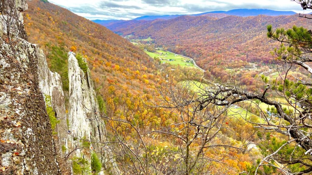
The Seneca Rocks Trail is 3.6 miles out and back and climbs 840 feet over those 1.8 miles to the summit. It’s a moderately challenging hike that people of all shapes and sizes can easily complete, even your pups, as the trail is dog-friendly.
The hike takes you to the edge of an impressive, rocky peak that rises above the forested mountain below. It is especially beautiful in mid-October when the leaves are changing colors.
However, ascending the jagged rocks at the peak can be harrowing. Although the rocks are technically past the trail’s end, they offer the best views for the adventurous hiker.
Prepare for Your Hikes Near Washington, DC
It’s always best to be prepared for any hike. This is what we recommend for any hiking adventure.
- Shoes: The trails below can be rocky and steep. As always, we recommend sturdy hiking boots or trail sneakers.
- Water Bottles: No matter how short the hike is, you’ll always want a water bottle on hand, especially in the hotter months.
- Bug Spray and Sunscreen: Mosquitoes and gnats can be in full force, depending on the time of year. A good insect repellant will make the hike more pleasant.
- Clothing: When hiking, you’ll want to dress in layers. It’s usually cooler in the mornings, but you’ll heat up as you walk along. Wearing T-shirts under lightweight zip-up sweatshirts is ideal in the spring and fall.
- Snacks or Picnic Lunch: Depending on which trails you choose and the time of day, you’ll want to have a few snacks or even a lunch ready to eat!
- Hand sanitizer / Hand Wipes: You never know when you need to wipe down! Especially before eating.
- Bandages: Isn’t it inevitable that someone will fall and scrape a knee on a rock? It’s always good to have some bandages or even a small first aid kit on hand.
- Backpack: To carry everything in. Need I say more? I prefer one with side pockets to hold the water bottles and a front pocket to hold the wipes and bandages. But you can use whatever you own.
Hikes Close to Washington DC Wrap-Up
There are so many beautiful hikes near Washington, DC. We couldn’t fit them all on this one list. But these are some of the best!
Of course, if you’re looking for some trails in DC, there are a few places close by that are perfect for a short walk or easy hike, including Rock Creek Park and Roosevelt Island Park.
Pin It For Later
