If you’re looking for a short hike near Princeton or Trenton, you’ll definitely want to check out the trails in Ted Stiles Preserve at Baldpate Mountain.
There are several hiking trails in Ted Stiles Preserve. We chose to hike the Summit Trail and Ridge Trail loop, which is just about 2.5 miles long. However, you can easily extend your hikes by adding the Northwest Loop or even the Copper Hill Trail.
For more information about hiking at Baldpate Mountain and the Summit/Ridge Trail, the guide below has everything you need!
Disclosure: Some of the links below are affiliate links, meaning, at no additional cost to you, we may receive a commission if you click through and make a purchase.
Multiple Hiking Trails at Ted Stiles Preserve
As mentioned above, one of the fun things about hiking at Ted Stiles Preserve is the option to mix and match the trails, though not as many as Sourland Mountain Preserve.
The guide below is about the Summit and Ridge Trail lollipop loop. Like I mentioned above, you can make the trek longer by adding the NW Loop Trail (red blazes) or walking the full Ridge Trail to the Copper Hill Trail and back. The choice is yours! Download the map to plan out your personalized Mercer County hike.
Prepare For Your Hike at Baldpate Mountain
Parking
There are a few places to park to hike at Ted Stiles Preserve, but for the hike below, you’ll want to park at the Fiddler’s Creek Road lot. The parking lot is large and holds about 40-50 cars.

If you are driving to the parking lot from River Road, you’ll see the main driveway first. Don’t go that way! There is a sign directing you to the parking lot, which is a little further up the street.
Amenties

There is a porta-john at the Fiddler’s Creek Road lot.
Pets
Leashed dogs are allowed on the trails at Ted Stiles Preserve
Download a Map

There are several trails that intersect on Baldpate Mountain. They are well marked, but it’s still a good idea to keep a map handy. You can download the map here, or take a photo of it at the trailhead.
A Short Hike in Ted Stiles Preserve at Baldpate Mountain
| Trail Location: | At the north end of the parking lot on Fiddler’s Creek Road. |
| Trail Length: | 2.3 miles |
| Trail Difficulty: | Easy side of Moderate |
| Trail Type: | Loop (lollipop) |
| Elevation Gain: | 390 feet |
| Dog Friendly: | Yes |
Trailhead For the Summit Trail (Blue Blazes)
The trailhead for the Summit Trail is at the north end of the Fiddler’s Creek Road parking lot. It’s pretty obvious and marked with a sign.
Along the Summit Trail
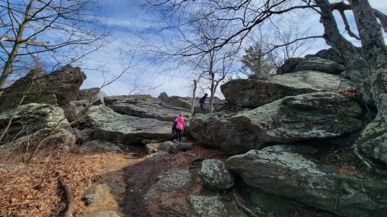
The Summit Trail (blue blazes) climbs up Baldpate Mountain at a relatively easy incline. There aren’t too many steep sections, however, there is a small “staircase” made up of rocks.


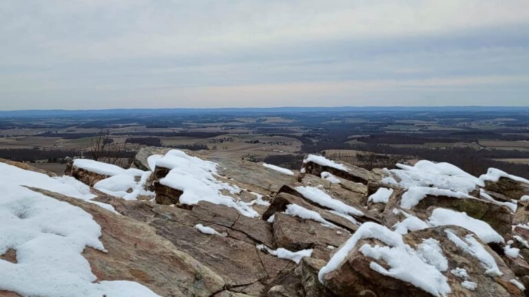
We’ve hiked the trail a few times, most recently in winter. This was a great time to go because you had beautiful views of the river and Pennsylvania in the distance as you ascended the trail.

Fork in the Road
About a half-mile into the trail, the Blue Trail splits. You can either go left or right.

We went left to reach the mansion and the views sooner. But, treating this trail as a loop versus an out-and-back, we returned via the trail on the right (as you’ll read about below).
At the Mansion

As you reach the top of Baldpate Mountain, take the time to enjoy the grounds of the mansion. From the terrace, you have some pretty views of the Delaware River.

In the early spring, the grounds are filled with daffodils and the cherry blossom trees are in bloom. It’s so pretty!
Connecting to the Ridge Trail (White Blazes)
Leaving the mansion, we followed the main driveway past the Summit (blue-blazed) Trail until it connected to the Ridge (white-blazed) Trail. That’s because the orchard was covered in snow.
However, it is possible to cross the orchard via the Summit Trail and connect to the Ridge Trail.
Either way, once you reach the Ridge Trail, make a right and head east.
The Ridge Trail
The Ridge Trail is flat and wide. It was covered in snow when we hiked, so I’m not sure if it’s gravel or paved. But we didn’t have to worry about any ankle breakers on the path.
Follow the trail about 4/10 mile to the Summit Trail (blue blazes) that begins just after the deer exclosure. The Summit Trail starts as a paved footpath and passes by an old farmhouse on the left.
Back on the Summit Trail
We got a little mixed up in this area, mainly because of the snow and the lack of noticeable blazes. But, using my trusty Strava App, we figured out which way to go.

You’ll want to keep the small pond to your left and follow alongside the deer exclosure for a bit. Eventually, the trail becomes more obvious, and the blue blazes are easy to find.
From there, follow the Summit Trail back down the parking lot!
Other Hikes Near Baldpate Mountain
There are some other fun trails nearby the Ted Stile Preserve that offer beautiful view and vary in difficulty.
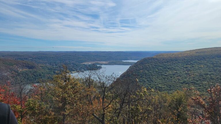
Goat Hill Overlook provides an easy half-mile trail to a gorgeous overlook of the Delaware River and New Hope in Pennsylvania. This is a popular spot to visit when the weather is nice so the parking lot can fill up very quickly.
My personal favorite is Sourland Mountain Preserve, about a half-hour drive from Ted Stiles. The preserve has several miles of moderately difficult trails and they pass by some large boulders that are fun to climb on. You can also see the Lower Manhattan skyline from Sourland on a clear day!
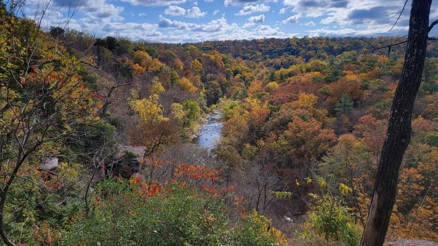
On the Pennsylvania side, High Rocks Vista at Ralph Stover State Park is about 30 minutes away from Baldpate Mountain.
Pin It For Later

