Monocacy Hill is one of those places you want to tell everyone about but also hope no one else figures out how great it is.
This beautiful park in Amity Township offers almost six miles of hiking trails ranging from easy to moderate. We visited on a beautiful September morning and completed a three-mile loop that was challenging enough to be fun but not to wear us out. But, you can mix and match the trails to make the perfect loop for you.
If you’re looking for a fun hike in Berks County that is both kid-friendly and dog-friendly, this is the place for you. The guide below shares everything you need to know before you go. So, let’s plan your next adventure!
Disclosure: Some of the links below are affiliate links, meaning, at no additional cost to you, we may receive a commission if you click through and make a purchase.
Monocacy Hill: Lots of Cool Features Packed Into One Park
Monocacy Hill Recreation Area is over 420 acres of forested fun. With almost 6 miles of trails that range from easy to moderate, it’s a perfect location for a family hike or a leisurely morning in the woods and one of our favorite places to hike in Berks County.
Even though it’s not a large park, there are still plenty of fun features along your hike, like the overlook, the quarry ruins, and a teeny tiny waterfall. But even without those, the walk through the woods is both beautiful and peaceful.
Prepare For Your Visit to Monocacy Hill
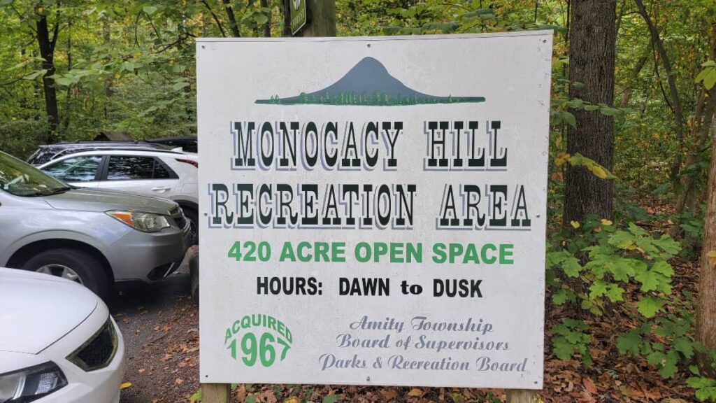
Parking at Monocacy Hill
There is a small parking lot for Monocacy Hill on Geiger Road in Douglasville. The lot holds about ten cars. However, you can also park along Geiger Road. Please be respectful of the private homes across the street.
Trail Map
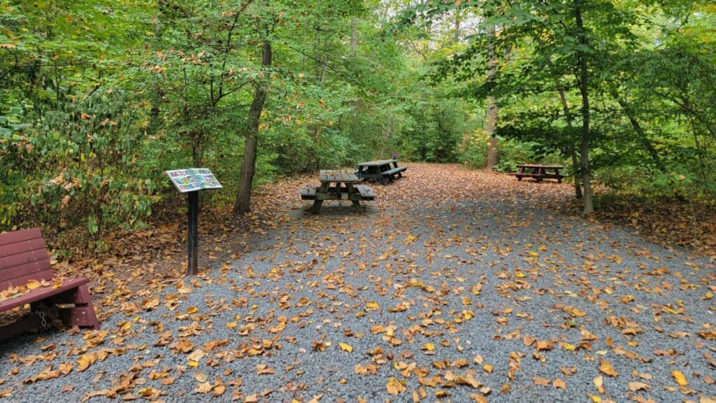
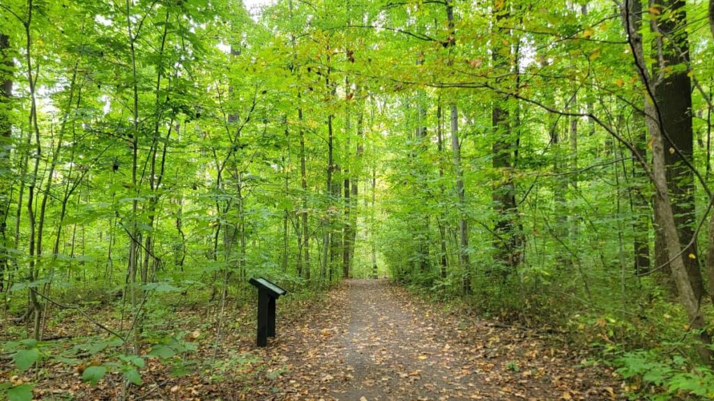
There is a large bulletin board at the entrance of Monocacy Hill with a map of the park for your reference. You can also download a map before your visit. Throughout the trails, there are several opportunities to scan a QR code to download a park map. And cell phone service is pretty strong, so you should be able to download it.
Amenities at Monocacy Hill
Monocacy Hill has two vault toilets near the park entrance on Geiger Road. They weren’t the worst toilets we’ve ever used, but if you can go before your visit, you might be better off!
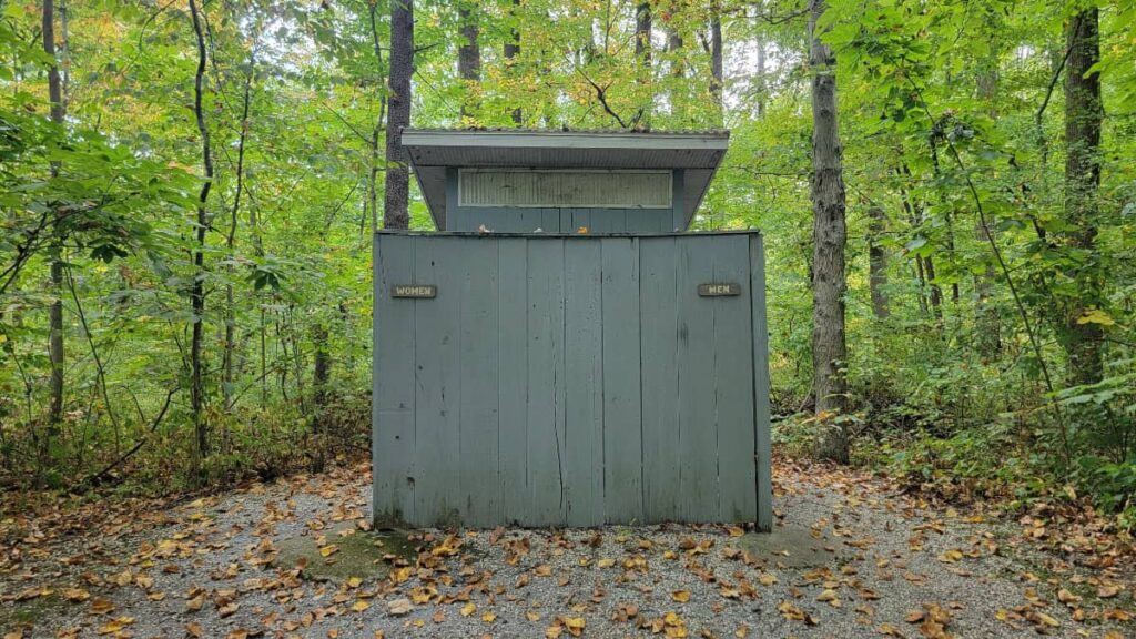
There are also picnic tables and charcoal grills next to the entrance.
Pets
Leashed dogs are allowed in Monocacy Hill Recreation Area. Please remember to clean up after your pooch! There are trash cans near the entrance if you need to dispose of any waste.
Be a Responsible Visitor
Remember, as you visit this park, to respect nature. Stay on established paths, pack out your trash (including food waste), and leave what you find behind.
The more popular these destinations become, the more diligently we must keep our parks and lands clean and safe for all. You can learn more here.
Hiking the Trails at Monocacy Hill Recreation Area
Choose Your Own Adventure
Monocacy Hill has over five miles of hiking trails, and you can easily mix and match them to make a fun loop.
We chose to hike Monocacy Hill to the Lower Loop to the Creek Trail, which was a 3-mile loop (more info below). However, if you’d like a shorter hike, the Lower Trail is about 2 miles long, and the Creek Trail to Lower Loop is about 1.7 miles long.
Trail Markers
I don’t know who is responsible for the trail markings and signage at Monocacy Hill, but they have done an EXCELLENT job! I would say they are even better than the signs at Hawk Mountain, which is saying a lot!
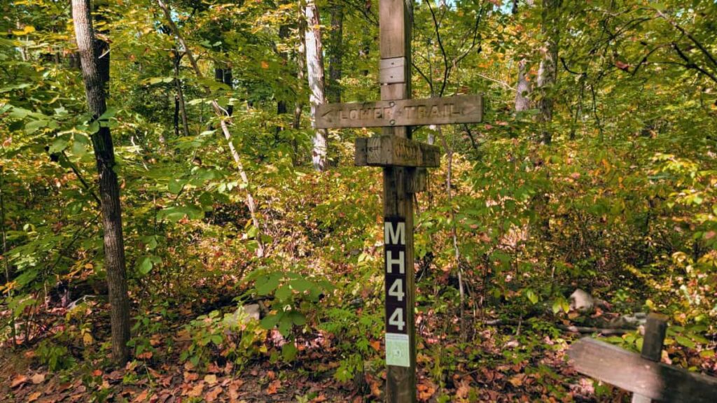
This was our first hike on which there were not only trail blazes but also location markers along the trail. Each trail had multiple posts with a number on it (MH44, for example), and you could reference the trail map to see where you were along the trail. If a visitor isn’t using an app like Strava or AllTrails, this is a great way to see how far along you are on the trail. Chef’s kiss!
Trail Condition
Just like the signage, the trails at Monocacy Hill are well-kept. Most of the trails are wide paths (enough for hikers to walk side by side or even three in a row if you’re with kids), and the footbridges were all in perfect condition. We enjoyed the boardwalk along the Creek Trail. It wasn’t muddy during our visit, but we could see how they’d be very useful after a good rain.
I also loved the number of wooden benches along the trail, especially after a steep section. Perfect for visitors to catch their breath after the climb.
Quarry Ruins at Monocacy Hill
Although the loop we completed (see below) didn’t go by the quarry ruins, I still wanted to see them! So we took a short hike to the ruins before returning to our car.
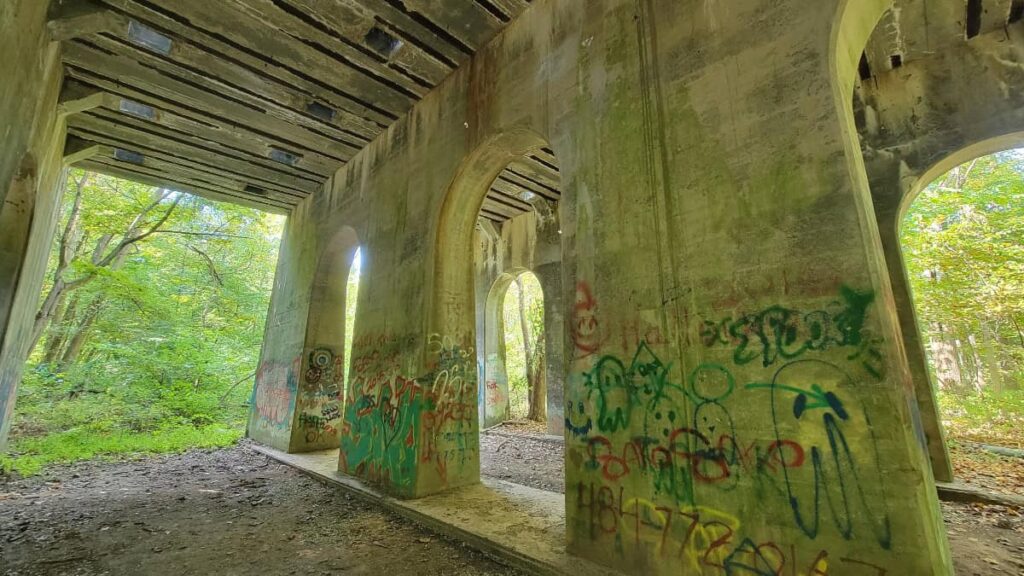
To see the ruins, take the Lower Trail from the bend on Geiger Road. Follow the trail about 2/10-mile until you see an interpretive sign. The ruins are just behind the trees. You’ll also see other parts of the quarry ruins, but they are not as accessible from the trail.
Monocacy Hill / Lower Trail / Creek Trail Loop
| Trail Location: | Monocacy Hill Entrance on Geiger Road |
| Trail Length: | 3 miles |
| Trail Difficulty: | Moderate due to the rocky portions of Monocacy Hill Trail |
| Trail Type: | Loop |
| Elevation Gain: | 525 feet |
| Dog Friendly: | Yes |
We chose to go counter-clockwise for this loop, moving southwest on the Monocacy Hill Trail. This made for a very steep descent on the Monocacy Hill Trail from the overlook.
Starting on Lower Trail
The Lower Trail (green blazes) is relatively flat and wide at the start of the trail. Although uneventful, it’s still a pretty walk, and visitors can enjoy some of the interpretive signs along the trail.
Monocacy Hill Trail
About 2/10 miles from the entrance is the Monocacy Hill Trail (white blazes). This trail takes you to the top of the hill and the overlook. It starts off wide, with limited rockiness. But you will walk uphill, with a grade between 10% and 15%, so it’s still a bit tiring.
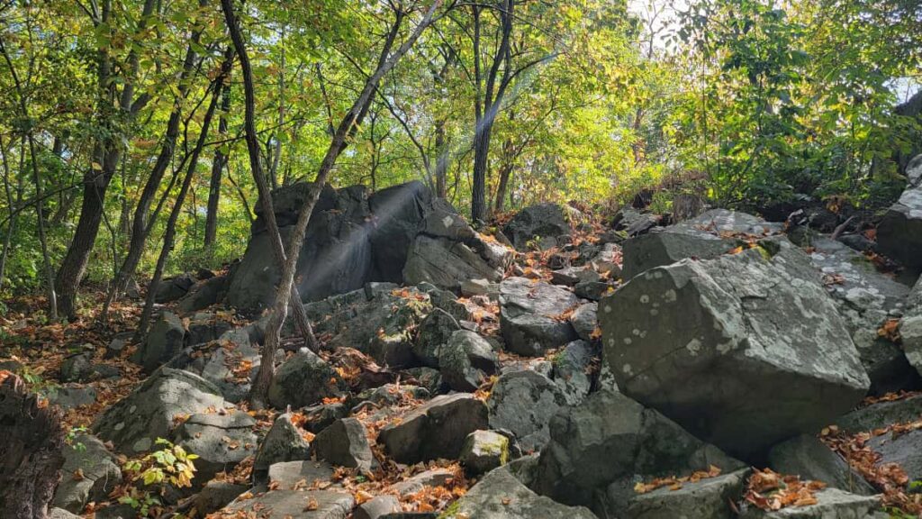
As you approach the peak, the trail narrows and becomes rockier. There are some large boulders at the top too.
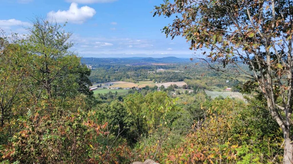
The overlook features a decent-sized rock outcropping. On our visit, another family was eating lunch at the overlook, and we still had room to enjoy the view. There is also a bench if you don’t want to sit on the ground.
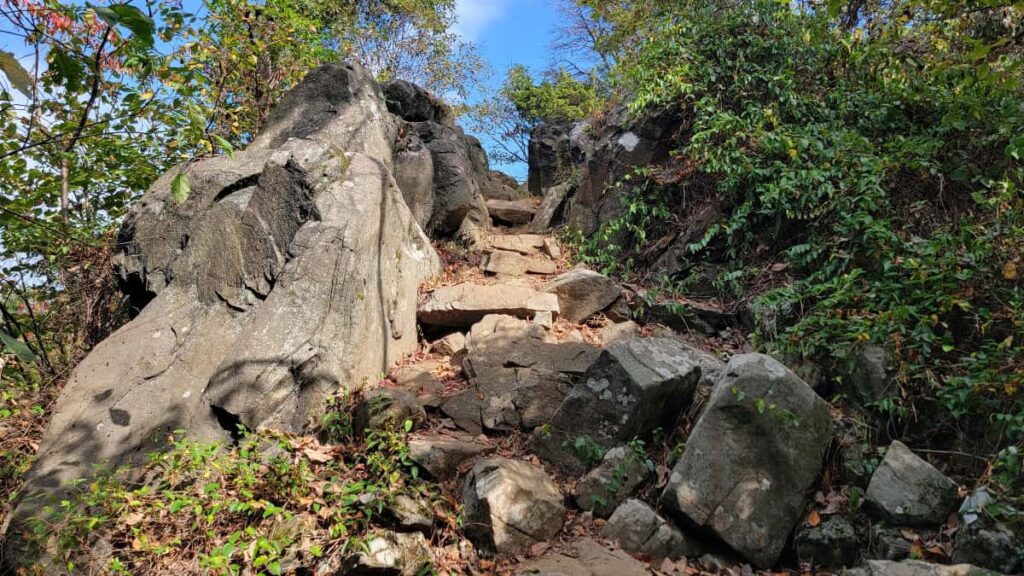
Heading down from the overlook is much steeper and rockier. The rocks could be slippery if you visit in the winter or after a rainfall. We took it slow thanks to the number of leaves on the ground. Hiking poles could prove to be useful in this section.
Lower Trail to the Creek Trail
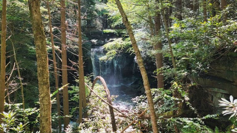
At the bottom of Monocacy Hill, you have the option to go left or right on the Lower Trail (green blazes). We wanted to head to the Creek Trail and check out the waterfall noted on the map. (Spoiler alert: It’s not much of a waterfall, but it’s still a pretty area of the park).
We followed the Lower Trail for about 7/10 miles. Along the way, we passed the entrance to the Stonewall Trail (red blazes). There, we stopped to read about the Shirrey Homestead.
Creek Trail
Instead of taking the Lower Trail directly back to the park entrance, we decided to lengthen our hike a bit by taking the Creek Trail (blue blazes). The Creek Trail descends from the Lower Trail to a small stream that runs through the park.
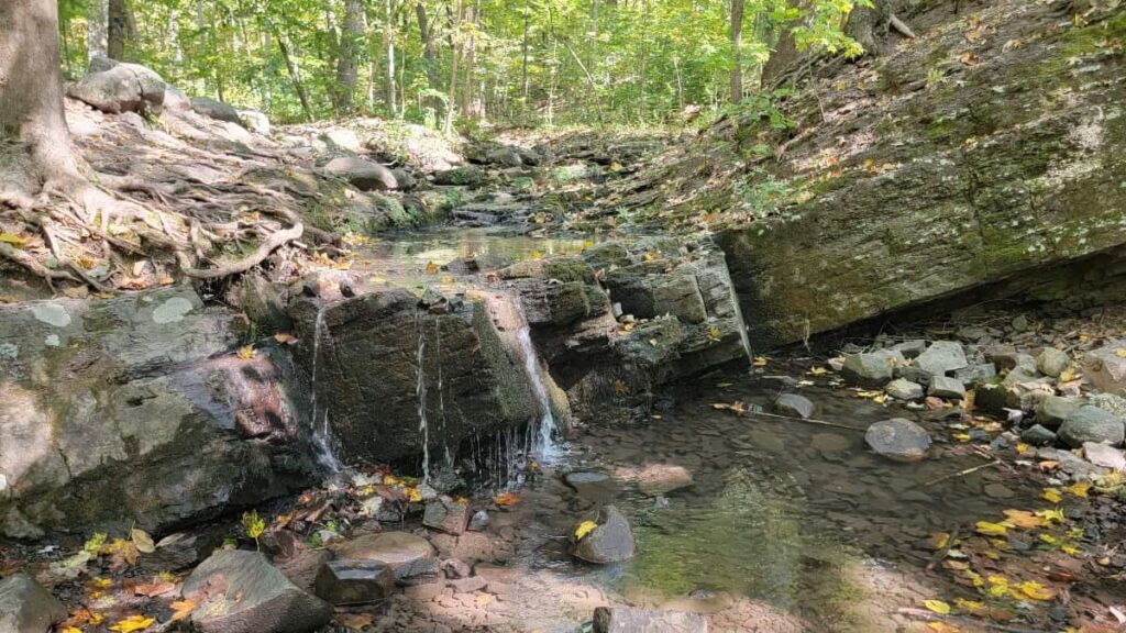
As you follow the stream, you’ll encounter the Monocacy Hill “waterfall.” I hesitate to call it a waterfall, but that’s how they mark it on the map. This area is very pretty, though, and there is a bench to sit on to enjoy the sound of the water.
After enjoying the sounds of the stream, continue along the Creek Trail. At one point, around the MH3 marker, you’ll see a trail leading to your right. There is even a little arched wooden bridge. That is not an official park trail, but I believe it exits out to the neighborhood. Instead, head up the hill towards the Lower Trail.
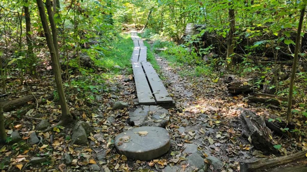
A large section of the Creek Trail is boardwalked. It was pretty dry on our visit, so the ground wasn’t muddy. But I’m sure the trail can get messy after a good rain, so this boardwalk is nice to have.
Monocacy Hill Hiking Wrap-Up
Overall, we really enjoyed our morning hike at Monocacy Hill. The well-maintained trails, the fun features along the way, and the overall peace and beauty of the park make it a great place to hike in Berks County.
Although there are more popular hiking trails in Berks County, like the Pinnacle/Pulpit loop and the trails at Hawk Mountain, I think Monocacy Hill is an easier alternative that is worth visiting.
Pin It For Later