The Maryland Heights Trail is a popular but challenging hike starting in Harpers Ferry. The 4.5-mile out-and-back trail features a steep climb to a stunning overlook of Harpers Ferry, offering a view of the confluence of the Potomac and Shenandoah rivers.
There are several unique features along the trail, including crossing a train bridge over the Potomac River, walking along the C&O Canal towpath, and taking in the incredible views from a rock outcropping.
This is a fun trail worth adding to your list of activities while visiting Harpers Ferry or doing a day trip from Baltimore or Washington, DC.
If you’re thinking about hiking the Maryland Heights Trail, the guide below has everything you need to know!
Disclosure: Some of the links below are affiliate links, meaning, at no additional cost to you, we may receive a commission if you click through and make a purchase.
A Little History About Harpers Ferry
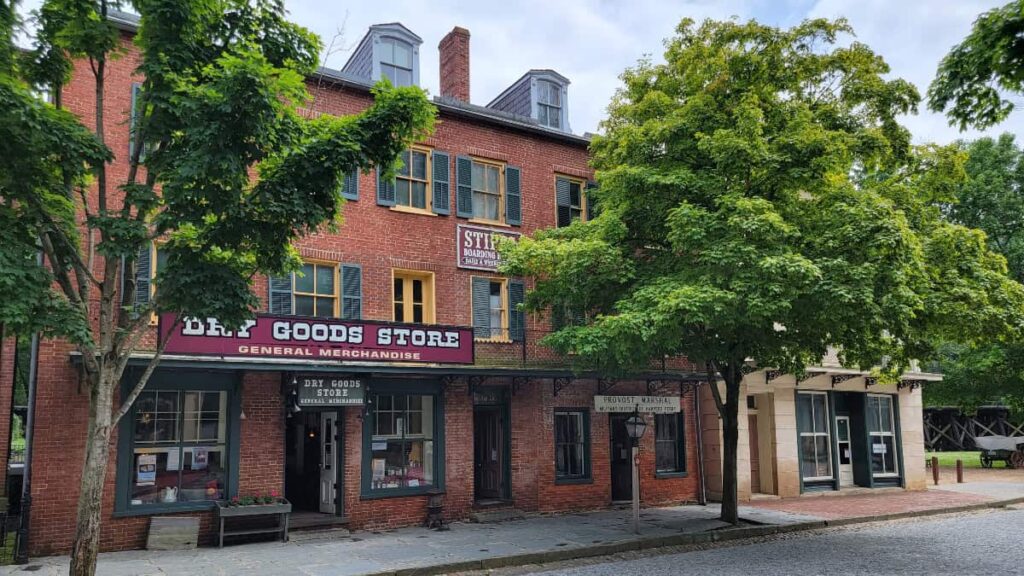
Harpers Ferry is a gem in West Virginia! It serves a vital role in American history and is surrounded by natural beauty.
Harpers Ferry is known for the 1859 raid on the federal armory, led by abolitionist John Brown. He was trying to spark a slave uprising. The raid was one of the catalysts of the Civil War.
Today, although Harpers Ferry serves as a living history museum of 19th-century America, its location along the Appalachian Trail makes it a popular stop for thru-hikers. And it’s not far from Baltimore or Washington, DC, making it an excellent option for a day hike!
Prepare For Your Hike to Maryland Heights From Harpers Ferry
Parking
You have a few different options to park for the Maryland Heights Trail at Harpers Ferry.
The best odds of finding parking is at the Harpers Ferry National Historical Park lot. It’s the largest parking lot in town, with a park shuttle that runs daily from the Visitors Center to Shenandoah Street in Lower Town Harpers Ferry. There is a fee to park, which also includes admission to all of the park buildings in town. If you have a National Park Pass, you can park for FREE.
You can also find metered street parking on Potomac Street and Washington Street in town. No cash is accepted in these meters, and you’ll have to use the Parkmobile app to pay. All other streets are resident-only parking.
Amenities
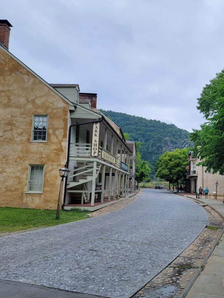
There are bathrooms inside the Visitor Center at the Harpers Ferry National Historical Park. There are also restrooms inside the Bookshop on Shenandoah Street.
Need equipment or something to eat? There are several shops and cafes in town along Potomac Street and High Street. We loved getting ice cream as a post-hike snack at Creamy Creations!
Download a Map
Cell service might be spotty for some providers, so it’s wise to download a map before you head out!
Pets
Dogs are welcome in Harpers Ferry and on the Maryland Heights Trail. Dogs must be leashed at all times
Be a Responsible Visitor
Remember to respect nature as you visit this trail. Stay on established paths, pack out your trash (including food waste), and leave what you find behind.
The more popular these destinations become, the more we need to be diligent about keeping our parks and lands clean and safe for all. You can learn more here.
Hike to Maryland Heights Overlook of Harpers Ferry
| Trail Location: | The trail begins on the east end of Shenandoah Street in Harpers Ferry. |
| Trail Length: | The trail to the overlook is about 2.2 miles (4.4 miles out and back) |
| Trail Difficulty: | The trail is on the harder side of moderate (for the last half) due to some steep sections. |
| Trail Type: | Out and back |
| Elevation Gain: | 1000 feet |
| Dog Friendly: | Yes |
Trailhead
The trail to Maryland Heights overlook officially starts in Harpers Ferry, WV. You’ll start at the end of Shenandoah Street, right next to John Brown’s Fort, and take the Appalachian Trail across the train bridge.
Crossing the Bridge
As you leave West Virginia, you’ll cross a train bridge over the Potomac River into Maryland. It’s not every day your hiking trail takes you over a river crossing state lines!

At the end of the bridge, take the stairs down to the C&O Canal Towpath. (You could walk or bike to Washington, DC, from here if you want. Don’t forget to stop by the Billy Goat Trail along the way😜.)
Canal Towpath
Make a left (go north) on the C&O Canal Towpath after climbing down the stairs. You’ll follow this flat trail for about a half-mile until you see a sign and a wooden footbridge for the Maryland Heights Trail.

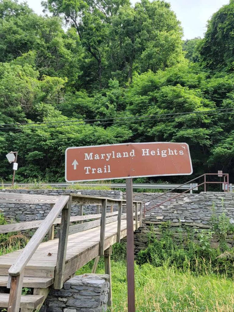
After crossing the footbridge, you’ll have to cross Harpers Ferry Road to access the trail.
Along the Trail
This portion of the trail is challenging due to the steeper grade. (It reminded me of the steep grade at Big Schloss.) However, it’s relatively wide and mostly clear of rocks and roots (until you get closer to the overlook).

Follow the green blazes on the Maryland Heights Trail for about .7-miles. Then you’ll follow red blazes to the overlook.
At the Overlook
You’ll know you’re getting close to the overlook when the trail starts to descend. The trail becomes narrower and rockier for this portion.

The overlook itself is pretty big, which is good considering how popular the trail is! From here, you get a great view of Harpers Ferry, Loudon Heights (another popular trail), and the confluence of the Potomac and Shenandoah rivers.
There is a short loop off the green-blazed trail that leads to the location of an old naval battery. The battery is no longer there, but it provides a pretty view. You can take that trail either on your ascent or descent from the overlook.
Extend Your Hike at Maryland Heights
The trail to Maryland Heights is about 4.5 miles, out-and-back. But you can extend it another two miles by including the Stone Fort Loop, which leads to the ruins of two batteries and a stone fort. It will also add about another 500 feet of elevation gain to your hike.
Other Hikes Near Harpers Ferry
Another popular trail near Harpers Ferry is the Loudoun Heights Trail to Split Rock. It’s about 6 miles, out-and-back with a 1450-foot elevation gain. It’s also a challenging trail, but the views are incredible!
Just outside of town, about a 10-minute drive into Maryland, is the Weverton Cliffs Trail. This is an easier hike to another beautiful view of the Potomac River. It’s about 2 miles out and back and features many switchbacks to make the ascent easier. We did the trail in winter and had a great time.
And, not a hike, but while you’re in Harpers Ferry, take a few minutes to follow the Appalachian Trail through town to Jefferson Rock. It’s a fun and unique feature!
Pin It For Later