
The Tri-State Trail to the Delaware/Maryland/Pennsylvania boundary marker is a beautiful, 3.5-mile loop that also takes you past the Arc Corner Monument.
Straddling both the White Clay Creek Preserve in Pennsylvania and the White Clay Creek State Park in Delaware, it’s the perfect trail for a casual hike in the morning with your kids or dog. And the scenery is absolutely gorgeous.
The guide below has everything you need to know about the trail and also a bit of history about the monument and marker (so you’re prepared when you visit!).
In this day and age, I feel the need to mention that I don’t use AI to write my posts!
I’ve hiked these trails, taken these photos, and collected this information personally (sometimes with the help of my friends, who are also real, live people). I appreciate you being here and utilizing my work for your future endeavors.
Also: Some of the links below are affiliate links, meaning that, at no additional cost to you, I may receive a commission if you click through and make a purchase.
Thank you for your support!
About the Tri-State Marker and Arc Corner Monument
Tri-State Marker
The Tri-State Marker and trail has an interesing history!
The Delaware-Maryland-Pennsylvania tri-state marker was orginally placed in 1765 by Charles Mason and Jeremiah Dixon (of Mason-Dixon Line fame). The first marker was made of wood and then replaced with the current stone marker in 1849.
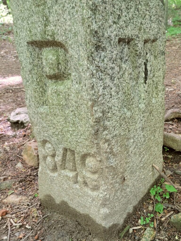
At some point, the marker went missing. It was located and the placed in the wrong spot. In 1849, the marker was moved to the correct location.
The marker was on private land until 2011, when Pennsylvania purchased the land. The current trail was developed and completed in 2015. Work was completed by 64 different volunteers plus an additional 117 volunteers to help complete the five Eagle Scout projects along the trail.
Arc Corner Monument
The Arc Corner Monument’s history is a little more complicated.
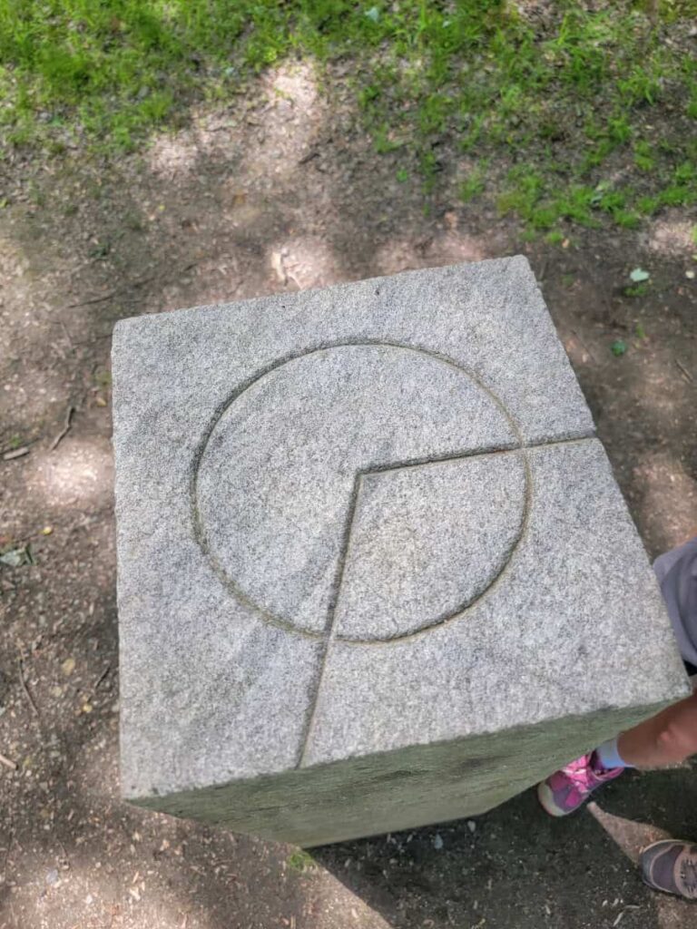
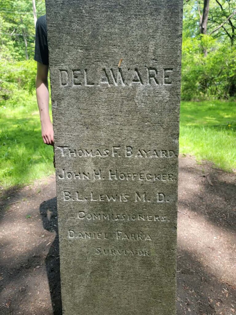
The survey that moved the Tri-State marker to correct location messed up the location of where Delaware, Maryland, and Pennsylvania met. This created a 714-acre space known as the “wedge” which became a part of Pennsylvania (but it was really supposed to be Delaware).
The wegde was returned to Delaware in 1889 and the location of where the arc intersects with the top of the wedge line was marked with the Arc Corner Monument.
Prepare For Your Hike on the Tri-State Marker Trail at White Clay Creek Preserve
Parking
The best parking area on the Pennsylvania side is on Arc Connector Road in Landenberg, PA. Follow the single lane road to the dead end where you see the entrance to the Arc Connector Trail. There is parking for about 6-8 cars.
An alternative is to park at the Chambers House Nature Center on Tweeds Mill Road in Newark, DE. The hike will be about the same length since you’ll cut off the Arc Connector portion of the trail.
Amenities
There are no bathrooms at the Pennsylvania parking area on Arc Connector Road. There are bathrooms at the Chambers House Nature Center on the Delaware Side.
Fees
If you park on the PA side, there is no cost to enter the park.
However, if you park at the Chambers House Nature Center, you’ll have to pay a fee of $4 (DE resident) or $8 (non-resident) per car. Fees are charged from March 1 to November 30.
Download a Map
There was a faded map on the sign by the Arc Corner Connector trailhead. However, you can download a nice map from either the Pennsylvania or Delaware State Park websites.
Pets
The Tri-State Marker Trail is dog-friendly. Dogs must be leashed at all times.
Be a Responsible Visitor
Remember, as you visit this park, to respect nature. Stay on established paths, pack out your trash (including food waste), and leave what you find behind.
The more popular these destinations become, the more we need to be diligent about keeping our parks and lands clean and safe for all. You can learn more here.
Hiking the Tri-State Trail to the MD/DE/PA Marker
| Trail Location: | Arc Connector Road in Landenberg, PA |
| Trail Length: | 3.5 miles |
| Trail Difficulty: | easy side of moderate |
| Trail Type: | Loop |
| Elevation Gain: | 230 feet |
| Dog Friendly: | Yes |
Trailhead
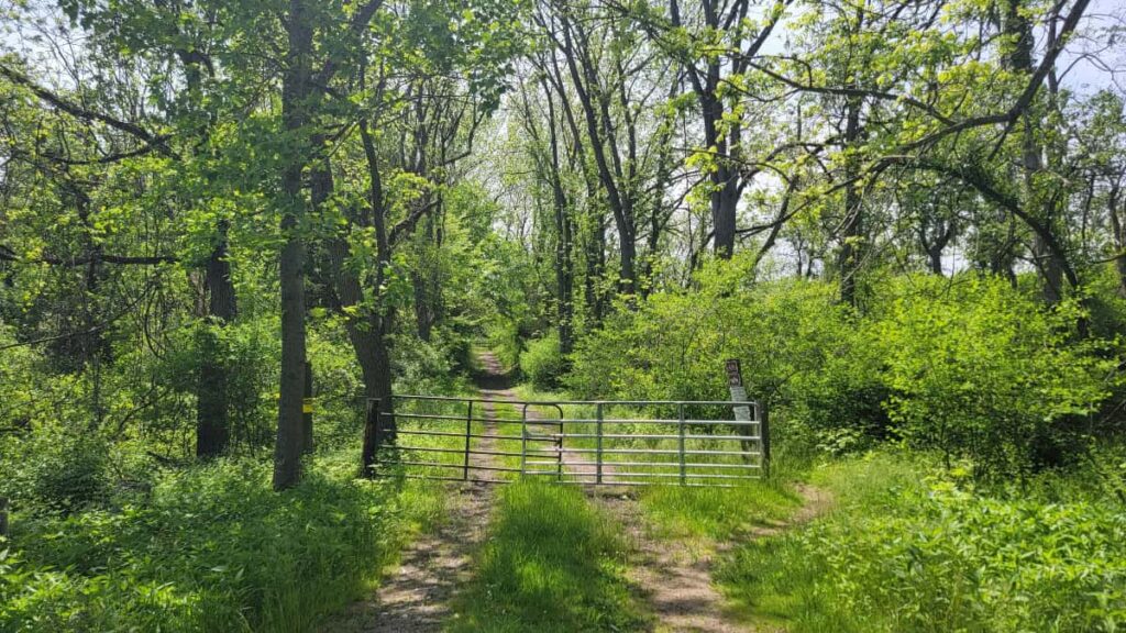
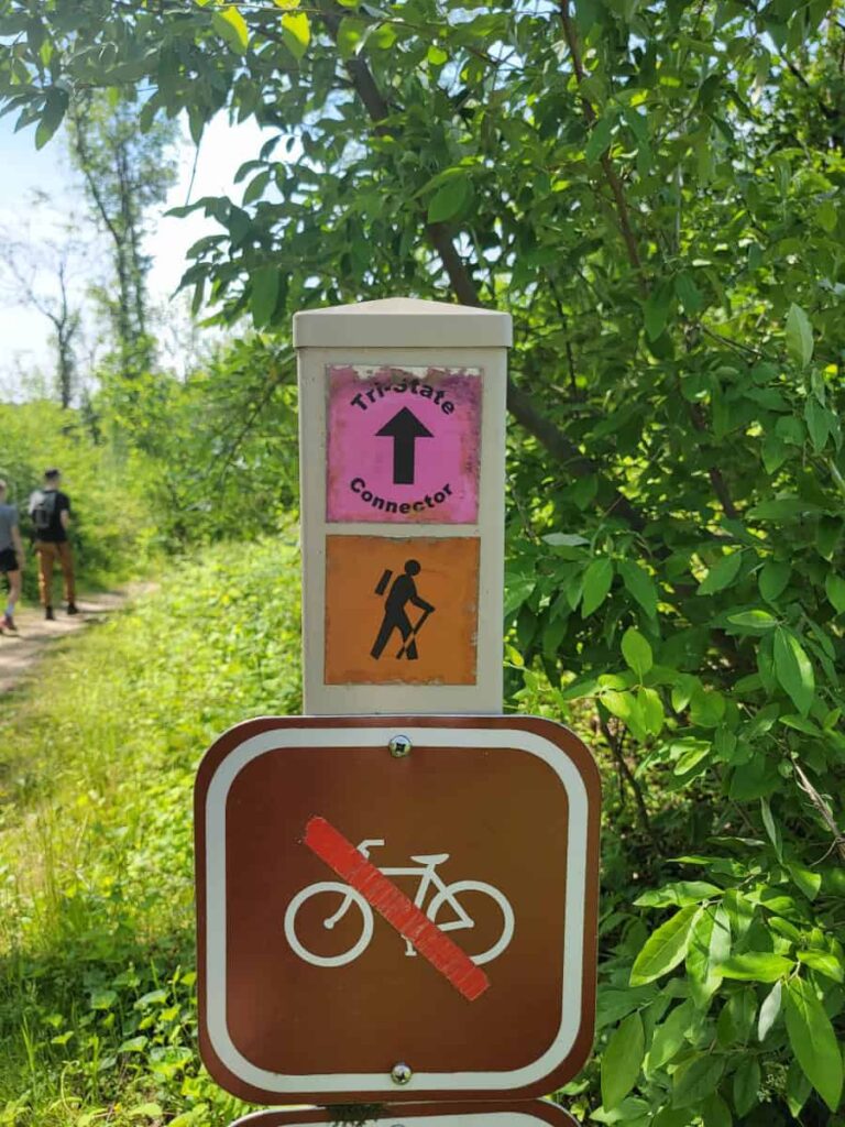
The trailhead is at the dead end of Arc Connector Road. There is a gate across the trail to stop cars from entering. The sign post has it marked as “Tri-State Connector”.
The Arc Corner Connector Trail
The Arc Corner Connector Trail is a wide, gravel and dirt trail. It cuts across both side of the Tri-State Marker Trail and continues to the Arc Corner Monument.
We chose to go counter-clockwise on the Tri-State Trail (which follows the numerical order of the fotobridges). Make a left at the first marker for the Tri-State/Mason-Dixon Trail marker.
Along the Tri-State/Mason-Dixon Trail
This is such a beautiful trail! It’s a single track dirt trail mostly through the forest at White Clay Creek Preserve. You’re a bit exposed to the sun as you cross the field, but otherwise, you’re protected.

The trail itself is also very clear. There are very rocks and roots along the trail.

There are several (17) wooden footbridges along the trail. They are all in great condition. Some of them were part of the Eagle Scout projects. There are also a couple benches along the trail.

The trail winds and weaves its way around the many tributatories of the creek. It’s a beautiful hike even though there aren’t any traditional views or waterfalls.
At the Tri-State Marker
The Tri-State Marker is about half-way through the loop. You’ll cross one of the foot bridges (I think it’s bridge number 10…) and then the marker will be towards your right. There are several sign posts directing you, so you won’t miss it.

The Tri-State Marker is fun to see! It’s always fun to stand in multiple states at one time.

Crossing State Lines

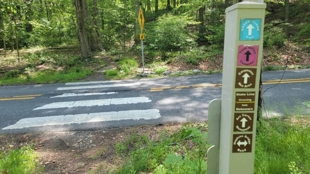
As you continue along the trail, you’ll cross from Pennsylvania into Delaware and then Delaware into Pennsylvania a few times before reaching the Arc Corner Connector Trail. Those crossings are marked by trail signs.
Spur to Arc Corner Monument
Once you reach the Arc Corner Connector Trail, make a right onto the trail and follow it about 1/8 mile until you reach Hopkins Road. Cross the road (look both ways!) and then you’ll come across the Arc Corner Monument almost immediately.
Afterwards, backtrack to the Arc Corner Connector Trail and stay straight on the trail until you reach the parking area.
Tri-State Trail Wrap-Up
We really enjoyed our hike to the Tri-State Marker. It’s a beautiful walk through the woods with a lot of fun history. We visited on a beautiful Sunday and it wasn’t too busy, which was nice. We also loved how well the trails have been upkept, espeically the nice signage. It reminded me of the quality at Monocacy Hill and Sourland Mountain. This is definitly a must-do trail in Delaware and southeastern Pennsylvania.
Pin It For Later