Mount Minsi has it all! From beautiful overlooks to water features and gorgeous rhodendron-covered paths, the Mount Minisi Trail is one of the most popular hikes in the Delaware Water Gap for good reason.
You have several options for hiking Mount Minsi, including a moderately challenging 5.8-mile loop with the east and south overlooks and a pretty waterfall. You can also shorten the loop to 4.5-5 miles, depending on the route you take.
Disclosure: Some of the links below are affiliate links, meaning, at no additional cost to you, we may receive a commission if you click through and make a purchase.
Mount Minsi Trail Options
Mount Minsi is one of Pennsylvania’s best overlooks on the Appalachian Trail. One reason it is so popular is the multiple trail length and difficulty options.
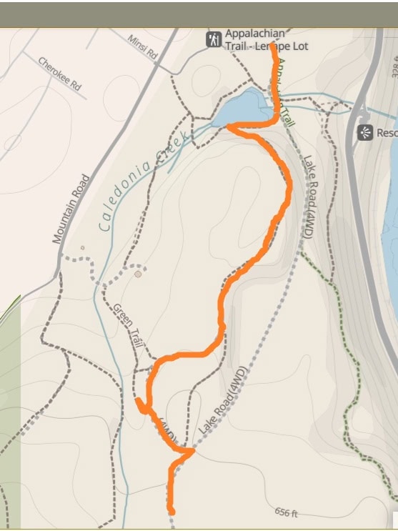
We chose to hike to the south overlook via the Appalachian Trail, then back down using Lake Road and detouring to the waterfall. According to my Strava, that loop was about 5.8 miles.
However, you have many other options depending on how long or strenuous you’d like the hike to be. These are a few ideas:
- If you don’t want to see the waterfall, stay on Lake Road for your walk back to the parking lot, keeping your total hike length around 5 miles.
- To avoid some of the more strenuous climbs, take Lake Road to the top. It’s about 2.3 miles one way or 4.6 miles total. There are still some steep spots along this trail.
- For a shorter hike to a nice overlook (even though it’s not the top of the mountain), take the Appalachian Trail to Lookout Rock, about 1.3 miles, and then return via the Appalachian Trail for a total of 2.6 miles.
Prepare For Your Hike at Mount Minsi
Parking for Appalachian Trail to Mount Minsi
There are two small parking lots for the Mount Minisi trail. The first, larger one, holds about 15 cars. The second is much smaller and holds about 6-8 vehicles. They are both accessed via Lake Road.

Both of those lots can fill up quickly during the summer and on the weekends. You can find more parking in town, along Main Street and Delaware Avenue. DO NOT park on Mountain Road or any of the neighborhood roads. Parking is prohibited, and you’re just asking to get ticketed or towed.
Amenities
There are no bathrooms at the Lake Lenape parking lot for Mount Minsi.
If you need a bathroom, the Pennsylvania Welcome Center is about a short drive (3 minutes) away. Unfortunately, it has been temporarily closed since November 2024 and has no current re-opening date.
Alternate options include the Walmart Supercenter in East Stroudsburg or the TA Travel Center in New Jersey, both about 10 minutes away. There are also several gas stations nearby, including a Sunoco in town.
Pets
Dogs are allowed on the trail to Mount Minsi as long as they are leashed.
Gear
This trail is challenging and steep in spots. Hiking poles would be beneficial. Also, wear ice spikes or crampons if you are hiking in winter. Several spots could be treacherous if icy.
Maps
Download a map or use an app like Strava or AllTrails to assist you on the trail.
Wildlife
Pennsylvania is home to many kinds of animals, including black bears and poisonous snakes. Always be mindful of your surroundings and watch out for wildlife.
Be a Responsible Visitor
Remember, as you visit this trail, to respect nature. Stay on established paths, pack out your trash (including food waste), and leave what you find behind.
The more popular these destinations become, the more we need to be diligent about keeping our parks and lands clean and safe for all. You can learn more here.
Mount Minsi Loop Trail
| Trail Location: | Lake Road in Delware Water Gap |
| Trail Length: | 5.8 miles (this includes checking out the waterfall – you can shorten to 5 miles by skipping the waterfall) |
| Trail Difficulty: | Harder side of moderate |
| Trail Type: | Loop |
| Elevation Gain: | 1100 feet |
| Dog-Friendly: | Yes |
Trailhead
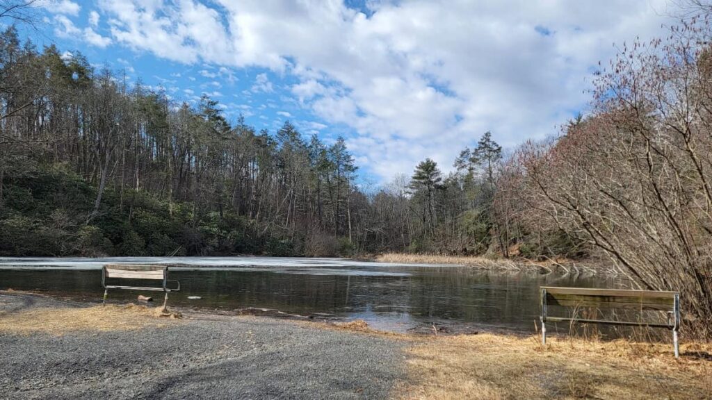
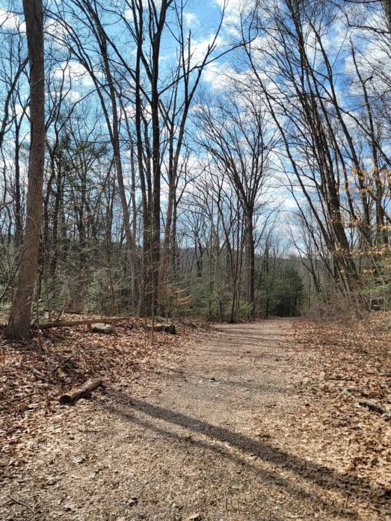
We started our hike at Lake Lenape Road, next to the parking lot. The road is dirt and gravel with a steady incline. You’ll pass Lake Lenape along the way (there are benches and a picnic table).
About 4/10 miles along the road, the Appalachian Trail will continue to the left. (Brush up on your blaze marker knowledge before you hit the trail!)
Council Rock Overlook
One of the nice things about this trail is the multiple overlooks along the way. The first is known as “Council Rock”. It overlooks the Delaware River, and you can see I-80 across the way.
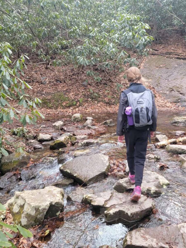
Eureka Creek Crossing
About a mile along the trail, you’ll encounter Eureka Creek. We visited in early March, so there was a fair amount of water to cross. However, I would think that in summer, it wouldn’t be as crazy.
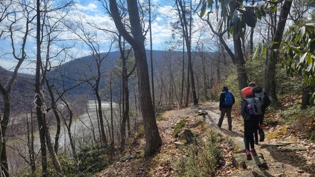
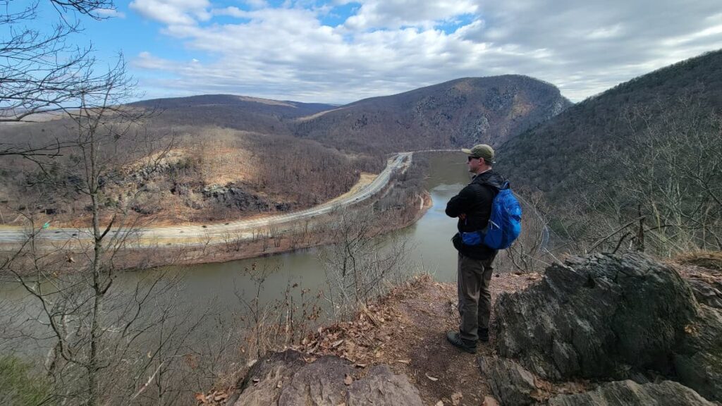
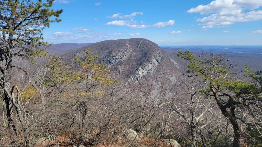
Lookout Rock
Probably the best overlook on the trail, Lookout Rock is about 1.3 miles into the trail. It’s open, with no trees in the way, so you can see the bend in the Delaware River, as well as Mount Tammany to the right.
To get to the overlook, follow the trail to the left before hiking up the Appalachian Trail on the right. Afterwards, backtrack along the trail to get to the Appalachian Trail to continue on.
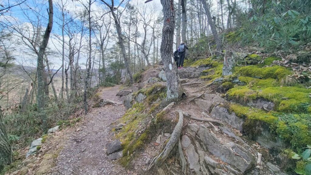
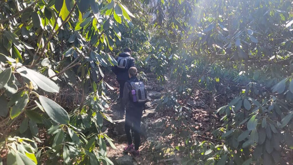
Continuing to the Top of Mount Minsi
From this point, the steep grades (up to 27%) really start to kick in. For the next 7/10 miles, you’ll hike through multiple rhododendron “tunnels,” as my kids called them, up several steep rocky staircases. It’s tiring but very beautiful.
Lake Road Intersection
As the trail levels out, you’ll reach the point where the Appalachian Trail crosses Lake Road. Take note of this because this is where you’ll pick up Lake Road for the hike back down. It’s not marked, but you’ll know it when you see it.
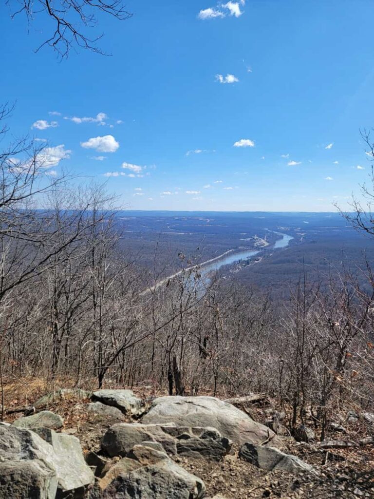
Mount Minsi East Lookout
Many people might stop, take in the view, and then turn around here, thinking they’ve reached the top. But there are two lookouts at the top of Mount Minsi!
This one, the east lookout, is about 2 miles into the trail and gives you a perfect view of Mount Tamanny (the sister mountain). Climb to the top of the outcropping for the best view.
Mount Minsi South Lookout
Continue another 3/10 mile along the Appalachian Trail to the south lookout. You’ll know you’ve reached it when you see the radio tower and stone ruins.
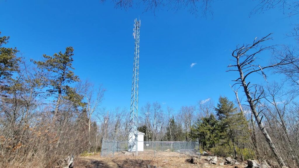
Continue on a few yards to the lookout. From here, you can see the Delaware River looking south and landmarks like the railroad viaduct and an electric energy plant.
Heading Back Down via Lake Road
After visiting the lookouts, return via the Appalachian Trail to the intersection with Lake Road. Instead of going right onto the Appalachian Trail, veer left at the fork to take Lake Road.
Lake Road is uneventful and not as steep as the Appalachian Trail. It’s kind of boring in that way, but not as bad as taking a service road. There are still many “ankle breakers” along the trail, so you need to watch where you’re stepping.
Once on Lake Road, it’s about 2 miles to the parking area. Or you can do what we did and detour to see the waterfall and cascades.
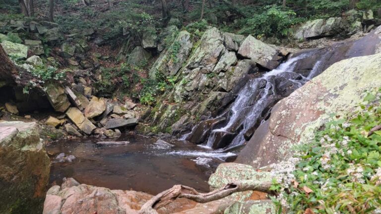
Waterfall Detour
About 1.5 miles down Lake Road, you’ll see a gravel/dirt path to your left. Follow that about 500 feet to another trail on your left. You’ll hear the water at this point.
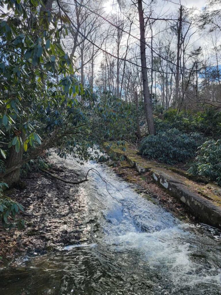
The trail leads to Caledonia Creek. You’ll see some gorgeous cascades if you turn right and head under the rhodenderons. It reminded me of Shades of Death in Hickory Run State Park.
Getting Back to Lenape Lake Parking Lot
From here, you can backtrack to Lake Road to finish the last half mile. Or do what we did and follow the trail to Lake Lenape. I’ve marked the way we went on the map below. This trail is unmarked but still very easy to follow. However, I would utilize an app like Strava or AllTrails to ensure you’re headed in the right direction.
Mount Minsi Loop Trail Wrap-Up
Overall, we really enjoyed this trail. The elevation gain is challenging in spots, but it’s worth it for the multiple overlooks.
Hiking it in March meant there was some ice along the trail. Thankfully, not enough to cause any issues. However, if you choose to do this trail in winter, I would wear ice spikes or crampons. There are plenty of spots for ice to gather and cause issues.
Other Trails Near Mount Minsi
The Delaware Water Gap is a popular place for hiking. There are so many beautiful trails in the area.
We loved Mount Tammany Red Dot Trail and the hike to Sunfish Pond across the river in New Jersey. For an easier hike on the Appalachian Trail, check out Wolf Rocks, which is about 10 minutes away.
Pin It For Later