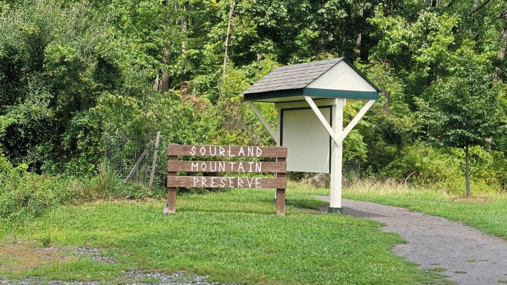
If you’re looking for a fun place for a day hike in New Jersey, look no further than the Sourland Mountain Preserve trails. With over 8 miles of trails throughout the 6300+-acre park, you can mix and match the trails to make the perfect hike for you.
We’ve hiked at Sourland Mountain Preserve many times over the past few years, over various seasons, and have enjoyed ourselves each time. Most recently, we made sure to stop by the New York City skyline viewing point right off the White Trail.
If you’re interested in checking out that view or want to learn more about the trails at Sourland Mountain, the guide below has everything you need to know.
Disclosure: Some of the links below are affiliate links, meaning, at no additional cost to you, we may receive a commission if you click through and make a purchase.
Sourland Mountain Preserve: Fun Hiking and More
Sourland Mountain Preserve is one of our favorite places to hike in New Jersey. With the many intersecting trails, you can create a new combination every time you visit, kind of like Hawk Mountain in Kempton, PA.
Our favorite areas include the Devil’s Half-Acre, where the kids love to climb around on the big boulders, and the New York skyline viewing spot.
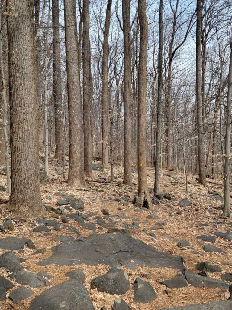
Overall, the trails are very rocky (ankle breaks and more), but they are fun to navigate. The trails are great to hike year-round, but you’ll want to be cautious after a snowfall due to the number of rocks along the trail.
Prepare For Your Hike at Sourland Mountain Preserve
Parking
There is a large parking lot at Sourland Mountain Preserve. Even on the busiest of days, you should be able to find a parking spot. (Don’t be discouraged if the lot is really busy – we visited when it was 75% full and still found the trails to be quiet).
Amenities
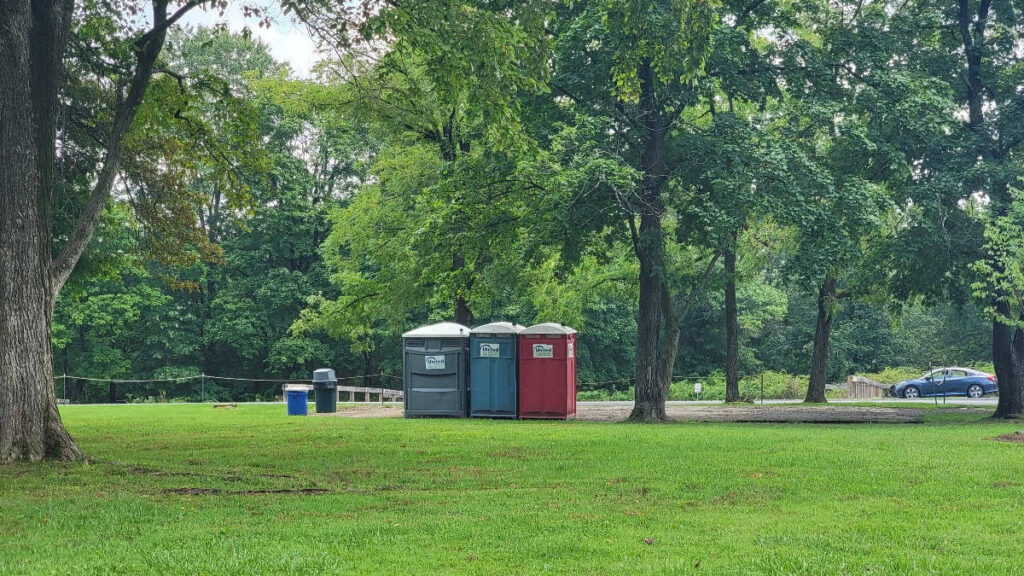
There are some porta-johns at the entrance. (Bring your own toilet paper and hand sanitizer).
Pets
Dogs are allowed at Sourland Mountain Preserve, but they must be leashed.
Maps
You can download a map before you leave. However, maps are posted at almost every trail intersection if you need them.
Be a Responsible Visitor
Remember, as you visit this trail, to respect nature. Stay on established paths, pack out your trash (including food waste), and leave what you find behind.
The more popular these destinations become, the more we need to be diligent about keeping our parks and lands clean and safe for all. You can learn more here.
Visitor Tip: Mountain biking is permitted at Sourland Mountain so keep an eye and ear out for bikers while on the trails.
Hiking the Trails at Sourland Mountain Preserve
Choose Your Own Adventure
Sourland Mountain Preserve has over 8 miles of trails throughout the 6300-acre park. You can easily mix and match them to create a loop that is perfect for you.
Typically, with the kids, we’ll hike the Orange (Maple Flats Trail) to Yellow (Devil’s Half-Acre Trail) and loop back around. That’s about 2.75 miles with 400 feet of elevation gain. But you can extend your hike even more!
Trail Markers
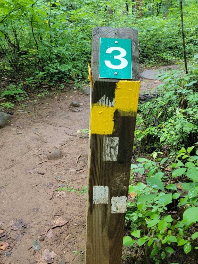
After so many hikes, you start to get an appreciation for well-marked trails. And Sourland Mountain Preserve’s trails are VERY well-marked. The trail blazes are very clear. And, at most of the trail intersections, there are trail posts with a map. It’s hard to get lost in this park.
Notable Areas
There are some interesting and fun spots within Sourland Mountain Preserve that you can enjoy while on the trail.
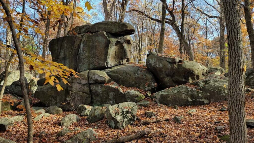
- Devil’s Half-Acre Boulders: This section has some large boulders that are fun to climb on
- NYC Skyline View: Along the opening for the Texas Eastern Pipeline just off the White Trail
- Roaring Rocks Boulders: An excellent spot for bouldering
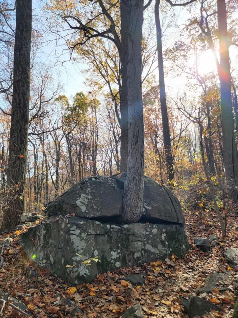
- Rock Eating a Tree: On the Yellow Trail, south of the Devil’s Half-Acre Boulders
- Rock Face: On the Yellow Trail east of the Devil’s Half-Acre Boulders
Hike to the NYC Skyline View at Sourland Mountain Preserve
| Trail Location: | Sourland Mountain Preserve parking lot |
| Trail Length: | The most direct route to the view is about 1.3 miles long (so 2.6 miles out and back) |
| Trail Difficulty: | Moderate due to the incline and rocky trails |
| Trail Type: | Out and back |
| Elevation Gain: | 400 feet |
| Dog Friendly: | Yes |
Starting on Orange/Maple Flats Trail
You’ll always start out on the Orange/Maple Flats Trail at Sourland, whether you pick up the trail by the lake or the signed entrance. You can go either way to reach the scenic NYC skyline lookout. If you choose to go by the lake, make sure to turn on the Maple Flats Connector (Orange Black Dot) for the most direct route.
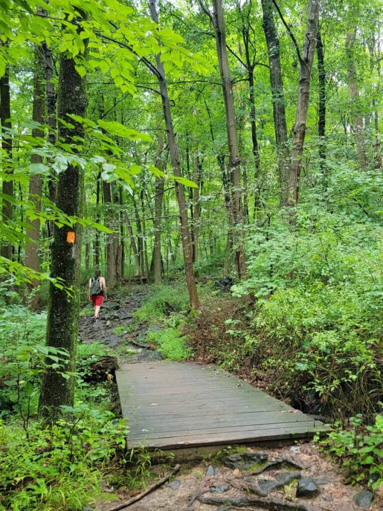
The Orange/Maple Flats Trail gives you a taste of what will come as far as rocks and steepness.
About 2/10 miles along the Orange Trail, you’ll come across Trail Post 1, which indicates the start of the Yellow Trail. That section of the Yellow Trail leads directly to the Devil’s Half-Acre. If you want to detour to the boulders first, you can head in that direction. But if you’re trying to go to the skyline view, continue along the Orange Trail for about another 2/10 miles until you reach the next Yellow Trail intersection.
Yellow/Devil’s Half-Acre Trail
Once you reach the second Yellow Trail intersection, head towards the right and take that for another half-mile until you reach the White Trail. This section of the Yellow Trail is very rocky (like the rest of the park), and it can feel steep.
Turn Left on White/Ridge Trail
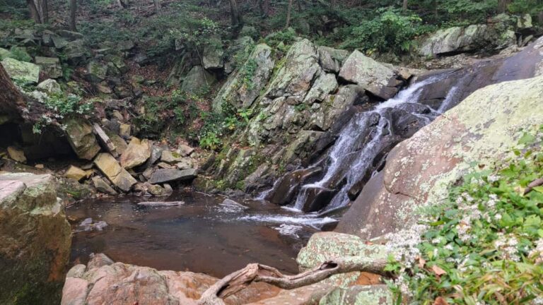
Trail Post 3 marks the intersection of the White and Yellow trails. To get to the skyline lookout, you’ll want to go left onto the White/Ridge Trail. As you walk the 3/10 mile to the Texas Eastern Pipeline clearing, you’ll pass the entrance to the Red Trail and also a tiny water run.
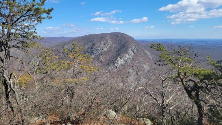
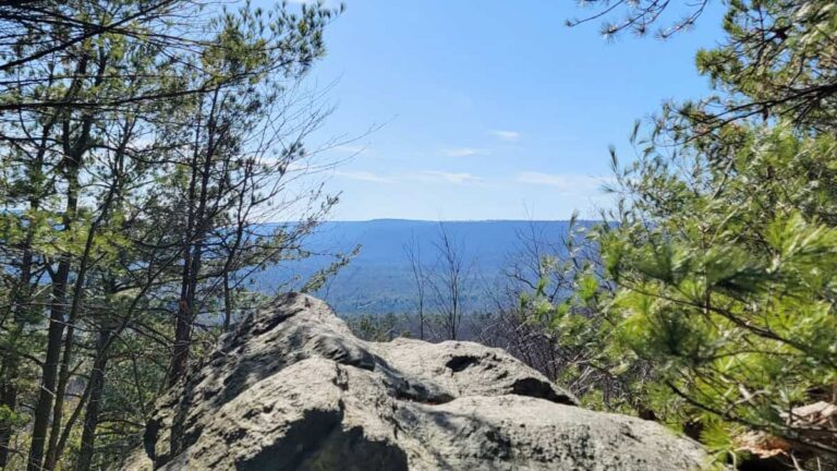
New York Skyline Viewing Point
Once you’ve reached the large clearing, head towards your left. Then, at the top of the ridge, head towards the right side of the clearing. There is a bench in the best position to see the skyline. There is a white-domed structure (I can’t figure out what it is) that is right below the skyline.
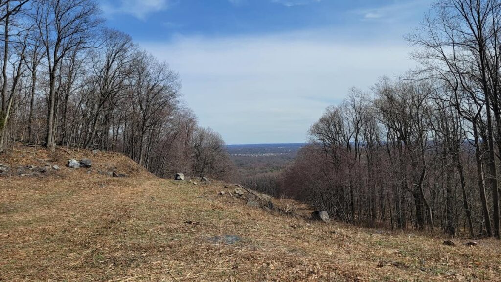
If the sky is clear enough and you zoom in on your phone, you should be able to see One World Trade Center. You might even be able to make it out with the naked eye. It’s about 40 miles away, so it’s still pretty impressive that we can see it, even if we have to use a phone!

Continue or Return?
From here, you retrace your steps to return to the parking lot. If you choose to treat this at an out and back, it’ll be about 2.6 miles in total.
However, you can extend your hike by about 2 miles, continuing along the White Trail and looping back down to the Orange Trail. Or lengthen the trail about 1.5 miles by adding on the inner loop of the Blue and Red trails. There are so many options!
Sourland Mountain Preserve Trails Wrap-Up
Sourland Mountain Preserve is the perfect day-hike location for those looking to get in a fun hike for the day. Whether hiking to see the view of the New York skyline or climb around on the rocks, it’s the perfect park for everyone to enjoy.
Enjoy this video of our hike on the Orange and Yellow Trails from August 2024.
Other Trails in New Jersey
Pin It For Later